A lone hiker stands atop a rocky outcrop overlooking the rugged landscape of Antelope Island and the hazy waters of the Great Salt Lake in Utah.

Author: Gary Donaldson

  • Tatanka!  The American Bison of Custer State Park

    Tatanka! The American Bison of Custer State Park

    Once, more than sixty million bison covered the American plains. The sound of their passing was said to be like thunder and would shake the earth. The ever-moving herd would go on for miles. Days would go by before it would moved out of site.

    Tatanka is the name given to this ancient animal by the Lakota people of the Sioux Nation. Specifically it means, bull or male bison (or, buffalo). However, among the Lakotas, the word, Tatanka, carries deep spiritual and cultural meaning. It refers to a sacred being intricately linked to sustenance, and the balance between humans and nature. The word implies reverence, kinship and a symbiotic relationship. The bison was central to existing on the open plains. It gave food, shelter, clothing and tools. Its nomadic grazing helped the plains achieve a crucial biodiversity. The buffalo was uplifted in ceremony and spiritual teachings. The Lakotas said, “Tatanka gave himself so our people could live.”

    Long ago, the American Prairies looked like this everywhere. Millions of bison drifting across the plains like slow moving weather.
    Long ago, the American prairies looked like this. Millions of bison drifting across the plains like slow moving weather.
    Bison Bulls at rest on the grasslands of Custer State Park
    Bison at rest on the grasslands of Custer State Park.

    “The Avarice and Thoughtlessness of Man” *

    Then came the rifles, the railroads, the freight wagons filled with hides. The pioneers called it progress. The army generals called it strategy. By killing the bison, they starved the people who lived with them. By the 1880s, the thunder had gone silent. Bison in North America were almost biologically finished by 1889.
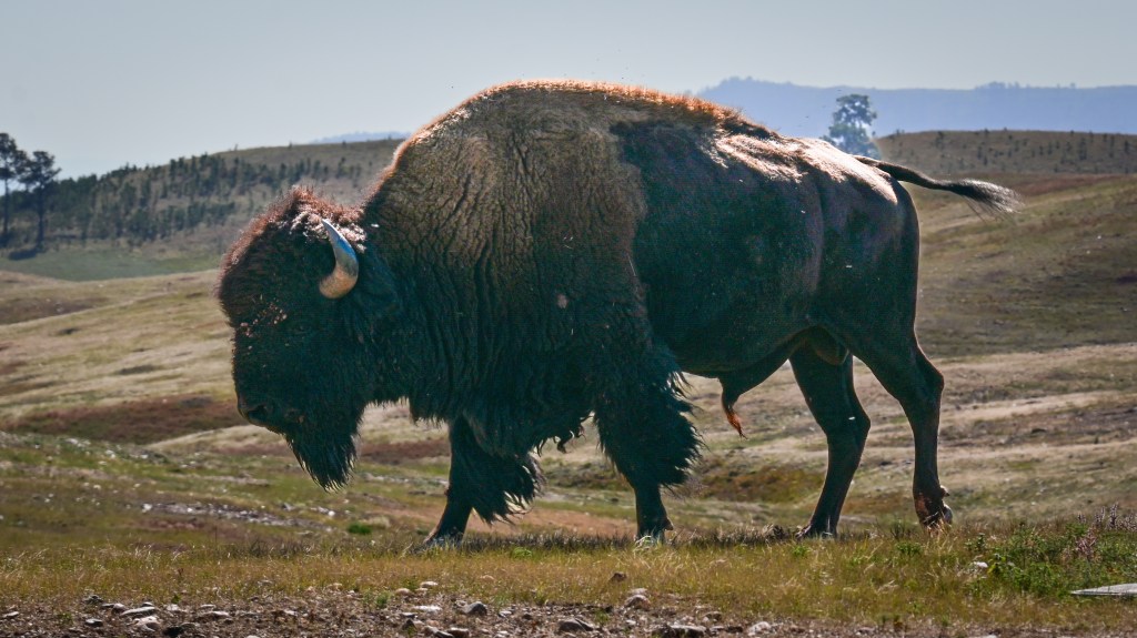
    A lone, old bull walks slowly - to somewhere. Perhaps drawn by instinct, tied to the season, only he remembers.
    A lone, old bull walks slowly – to somewhere. Perhaps drawn by instinct, tied to a season, only he remembers.

    “To watch a bison walk is to witness the patience of time and the dignity of survival.”

    Recovery of the American Bison

    In 1914, the Black of Hills of South Dakota received 36 buffalo, trailered into what would become Custer State Park. Thirty-six survivors from the decades of slaughter.

    The buffalo adapted well to their new home. By 1924, the herd had already reached 100 animals. The herd kept expanding through the 20th century. Eventually, wildlife managers realized something important. This was a growing, wild herd of buffalo grazing on a finite area of grassland. A balance needed to be struck between buffalo and prairie.

    Today, Custer State Park manages one of the largest publicly owned, free-roaming bison herds in the world. The herd’s numbers vary between approximately 1,000 to 1,400 animals, depending on the season and the health of the parks 71,000 acres of grassland and ponderosa pine.

    Bison of Custer State Park
    A new horizon for the American Buffalo at Custer State Park.
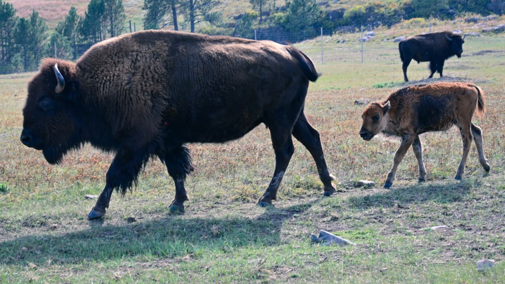
    Mothers and calves on the grassland. A new rumble on the prairie.
    Mothers and calves on the grassland. A new rumble on the prairie.

    Buffalo of Custer State Park, Up Close and Personal

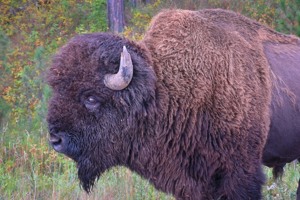
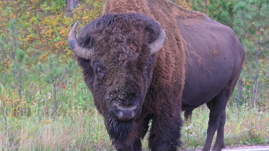
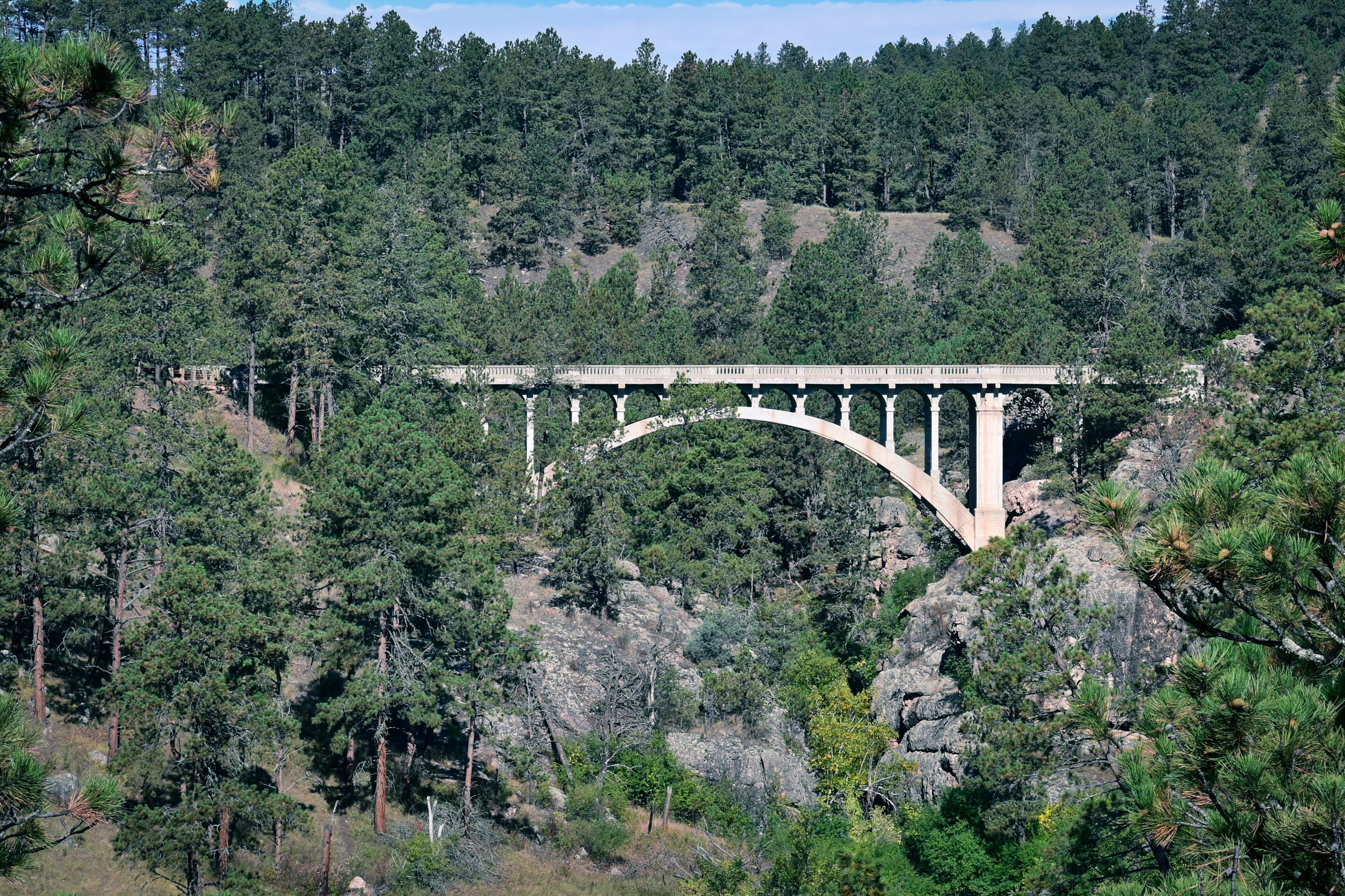
    I wanted to snap some photos of a beautiful bridge inside Custer State Park. There was a pull off about 30 yards up the road. I opened the truck door, stepped out, then reached back inside to gather camera and tripod. Closing the door, I turned and started walking to the overlook. That’s when I saw him. A very large bull raising up from his nap against a large rock. Apparently, I had disturbed him. His demeanor was not the typical passive indifference to tourists. He snorted at me in a noticeably irritated manner – snot blowing from his nostrils. His stance communicating warning. My camera was set to take photos, which I did – of him – hurriedly. Then I got back in the truck and found a different place to park.

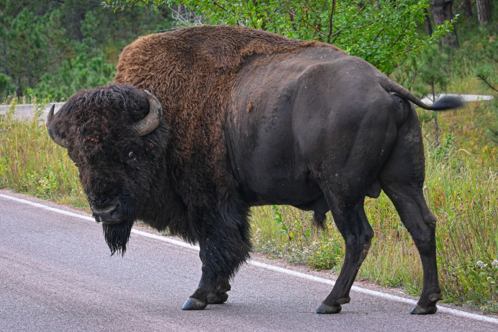
    Buffalo have the right of way on the roads of Custer State Park.
    Buffalo have the right-of-way on the roads in Custer State Park. Drive accordingly when visiting.
    Up close the buffalo is both beautiful and intimidating.
    Up close, a buffalo is both beautiful and intimidating.

    Tall grass sways on hills,
    nodding to the memory –
    mighty Tatanka.
    Long the prairie held its breath –
    rumble of distant thunder.


    * (An excerpt from a plaque about the extinction of the Passenger Pigeon. Applicable here, as well). View my photo HERE.

    Stay tuned for the third installment from Custer State Park.

    A teaser:

    Bull Elk on a Ridgeline
    Bull Elk on a Ridgeline
  • Custer State Park and the Black Hills of South Dakota

    Custer State Park and the Black Hills of South Dakota

    Over two billion years ago, the landscape we know as the Black Hills began deep in the earth’s crust. A gigantic bubble of molten rock (magma), roughly the size of Connecticut, slowly cooled into granite. The granite locked in minerals like quartz, feldspar, and mica. For millions of years it lay buried under ancient seas. Then, powerful forces within the earth shoved the granite mass (a batholith) upwards like a piston, folding and cracking the top layers of land to form the dome of the Black Hills.

    Over geological time (millions of years), wind, rain, and ice eroded the softer sedimentary layers away, revealing the granite and other hard minerals. Erosion continued in the folds and cracks of the granite. Eventually sculpting the landscape into what we see today in Custer State Park and the Black Hills of South Dakota.

    Towering Spires

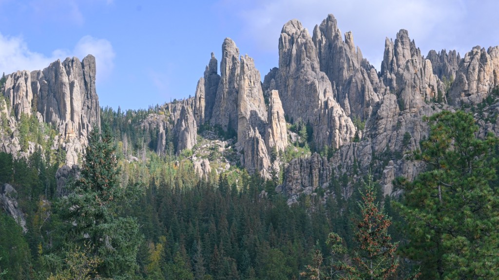
    The Needles Highway in Custer State Park winds its way along towering granite spires.
    The Needles Highway in Custer State Park winds its way through towering granite spires.

    * Click on images below to expand (desktop & laptop).

    These jointed granite columns rise like organ pipes above the Ponderosa Pines of the Black Hills. Weathering along fractures create sharp vertical walls and narrow corridors.
    These jointed granite columns rise like organ pipes above the Ponderosa Pines of the Black Hills. Weathering along fractures create sharp vertical walls and narrow corridors.

    A Hike to the Geological Center of the Dome

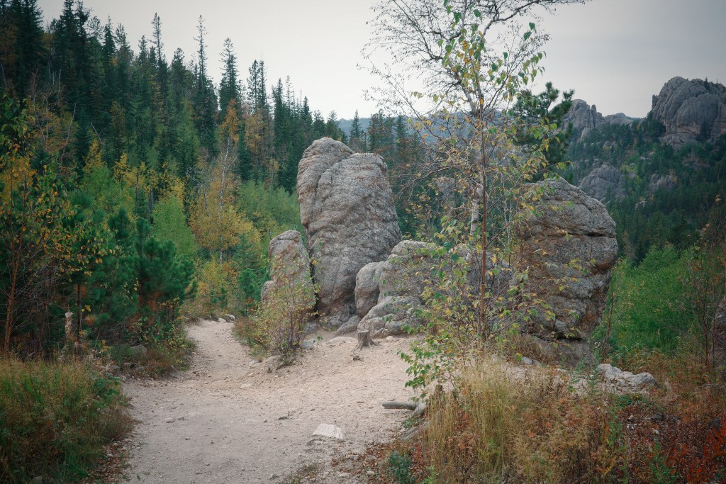
    Fall Colors Line the Trail to Little Devil's Tower
    Fall colors line the trail to Little Devil’s Tower. The upper section of the trail is sprinkled with mica that sparkle like tiny diamonds.
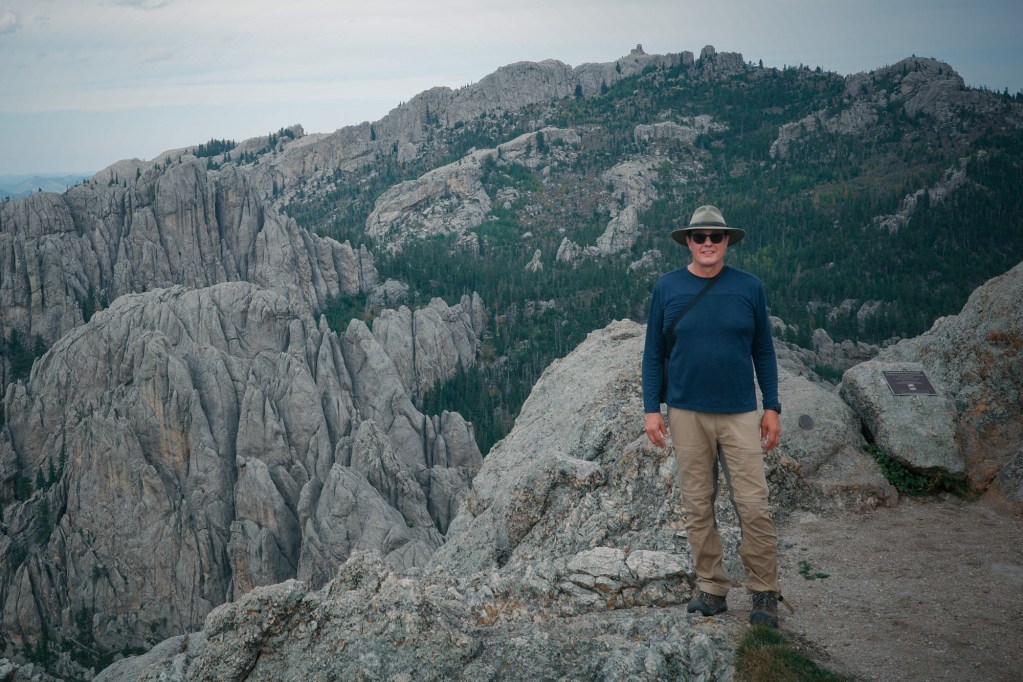
    A rare photo of myself on this site. I'm standing on the summit of Little Devils Tower (6,959ft). Behind me is the highest point east of the Rocky Mountains. At 7,244ft, Black Elk Peak is literally the crown of the granite batholith—the solidified magma body that forms the core of the Black Hills uplift.
    I’m standing on the summit of Little Devil’s Tower (6,959ft). Behind me is the highest point in the U.S. east of the Rocky Mountains. At 7,244ft, Black Elk Peak is the crown of the granite batholith, shoved up from earth’s crust to form the core of the Black Hills uplift.
    These cathedral-like spires are remnants of a Granite batholith. They're sculpted by millions of years of weathering, leaving behind the jagged skyline that defines the central Black Hills.
    These cathedral-like spires are remnants of the Granite batholith. Sculpted by millions of years of weathering, leaving behind the jagged skyline that defines the central Black Hills.

    Icons of the Black Hills

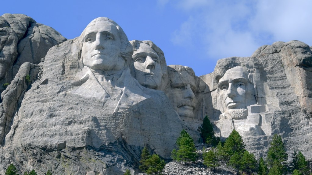
    Mount Rushmore. The sculpture is carved directly into Precambrian granite along with veins of crystals of quartz and feldspar (seen here as lighter streaks across the forehead of Lincoln).
    Mount Rushmore – The sculpture is carved directly into Precambrian granite along with veins of quartz and feldspar (seen here as lighter streaks across the forehead of Lincoln).
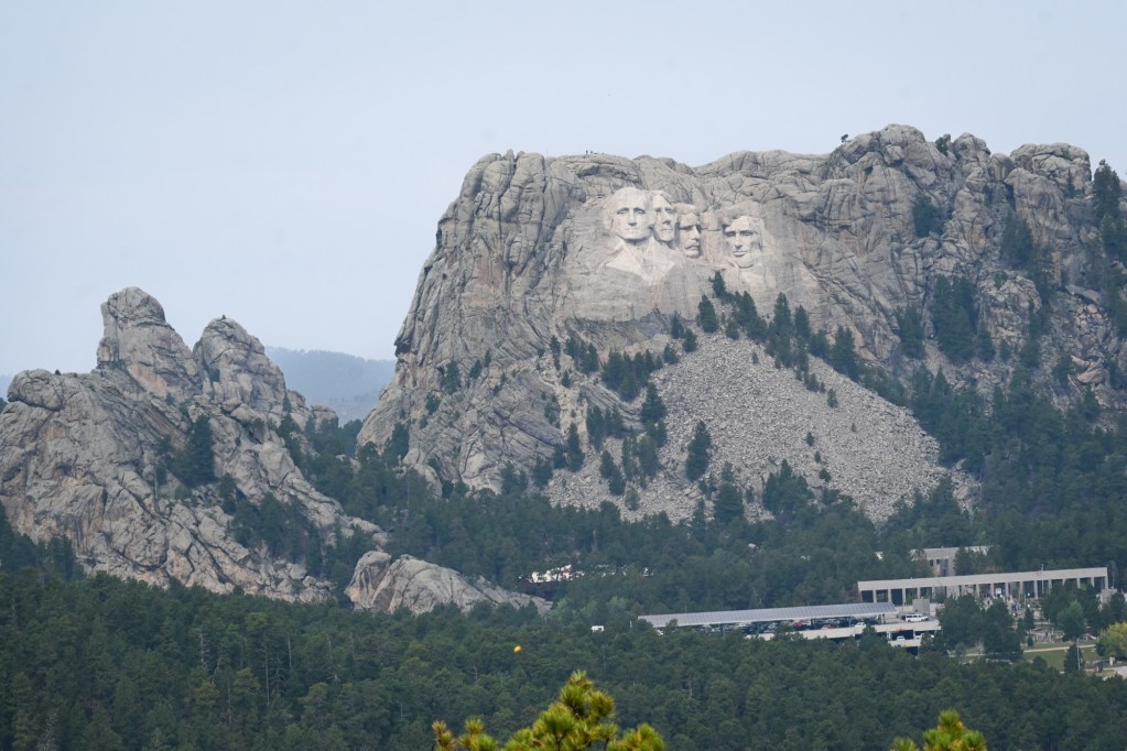
    Mount Rushmore rises from the same 1.7 billion-year-old granite peaks in Custer State Park.
    Mount Rushmore rises from the same 1.7 billion-year-old granite peaks seen throughout Custer State Park.
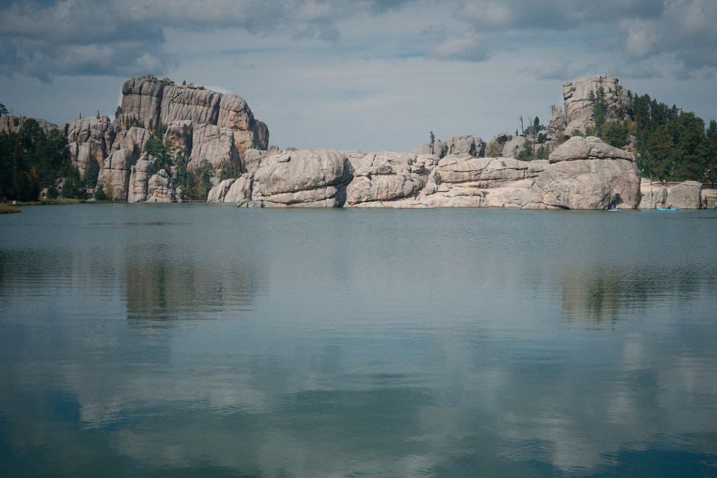
    The rounded cliffs around iconic Sylvan Lake are domes of granite that were lifted and exfoliated bare.
    The rounded cliffs at iconic Sylvan Lake are domes of granite, lifted and exfoliated bare. Sylvan Lake is the most photographed location in Custer State Park.

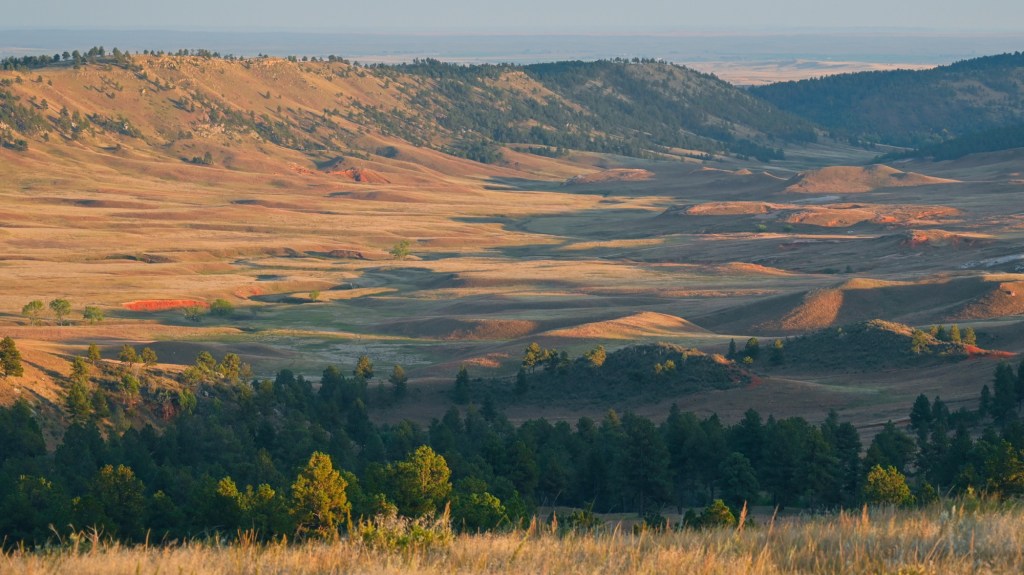
    Picturesque Rolling Hills and Prairies in the Outer Rings of the Black Hills.

    The "outer rings" of the Black Hills are eroded layers of rust-colored sandstone and shale that were deposited in a shallow inland sea.
    The “outer rings” of the Black Hills display eroded layers of rust-colored sandstone and shale deposited in a shallow inland sea that once covered the entire area.
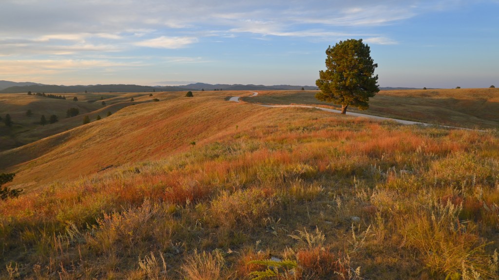
    Erosion of the Black Hills continues today. Here we see the rust-colored layers of the outer ring of the Black Hills.
    Erosion of the Black Hills continues.
    Last light over the Black Hills — one tree, one hill, and two billion years beneath it.
    One Tree Hill (nod to U2). Last light over the Black Hills.

    “The first peace, which is the most important, is that which comes within the souls of people when they realize their relationship, their oneness with the universe and all its powers…” — Black Elk (Oglala Lakota) 


    Here is a teaser:

    Tatanka
    Tatanka
  • Autumn Walk Along a Nearby Lake

    Autumn Walk Along a Nearby Lake

    A 5-mile Radius Project Post

    I placed the Ricoh GRIIIx in my pocket and walked along a favorite birding route one evening. Here are 3 images to share from this autumn walk along a nearby lake.

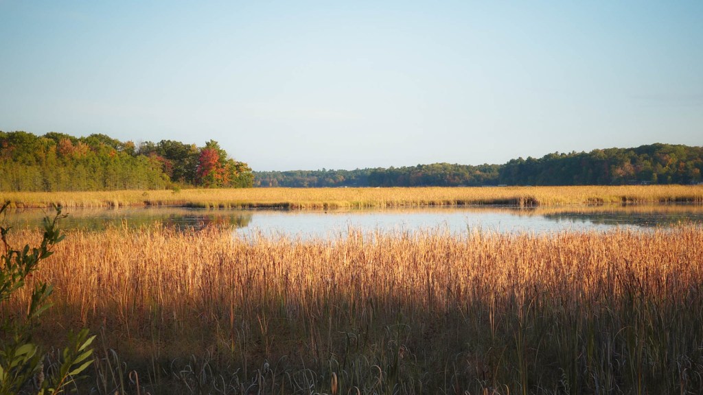
    Autumn comes to the marsh of Big Sand Lake, Northwest Wisconsin
    No wind. Only layers of golden texture mirrored by the pond. A moment of peace. Just when we need it.
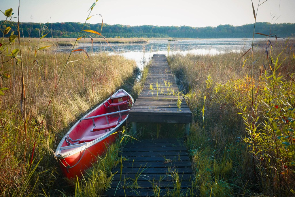
    Big Sand Lake Marsh with canoe and dock, Northwest Wisconsin
    So much depends upon / a red canoe / glazed with autumn light / beside the wooden dock.
    The evening sun shines through the trees on Big Sand Lake Rd. Northwest Wisconsin
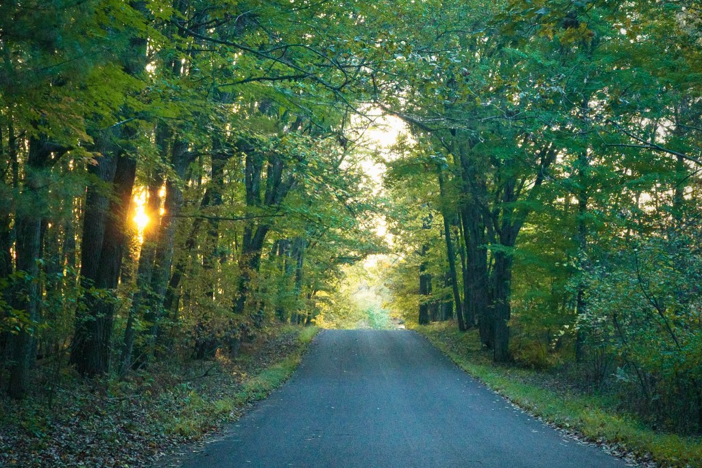
    I walked slowly down the middle of the road, soaking in the last rays of sun as it recedes between the trees. Darkness comes quickly this time of year on an autumn walk around a nearby lake.

    Do you know?

    the caption with the second photo was a nod to one of my favorite poets. Leave a comment below, if you know. Share what you think of this poet. Let us know of other poets that inspire you.

    Want to know the poet? Click here.


    Click here to see more!

  • Pipestone National Monument

    Pipestone National Monument

    Pipestone National Monument is located in southwest Minnesota, approximately 30 miles north of busy Interstate 90. I was fortunate to discover this fantastic little gem on a rural-focused route to Custer State Park in South Dakota.

    Pipestone National Monument Visitor Center
    Pipestone National Monument Visitor Center

    Designated in 1937. Pipestone National Monument is a site of important cultural, historical, and geological significance. It consists of almost 300 acres. Its terrain includes rolling tallgrass prairie, glacial deposits, Sioux quartzite outcroppings, and the sacred pipestone (Catlinite) veins layered beneath the quartzite.

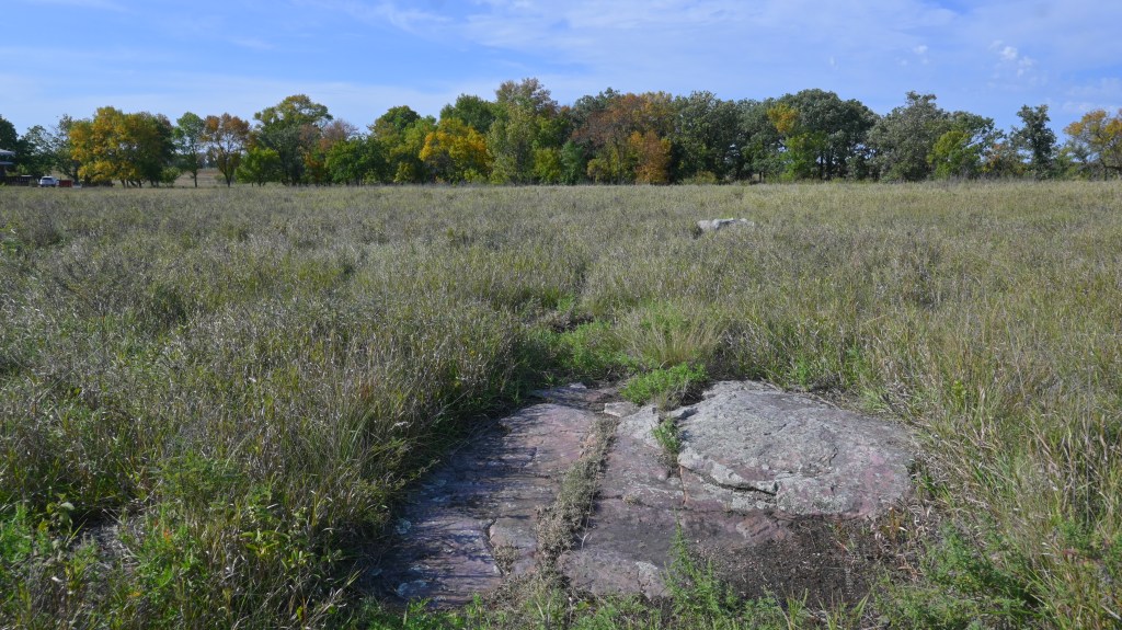
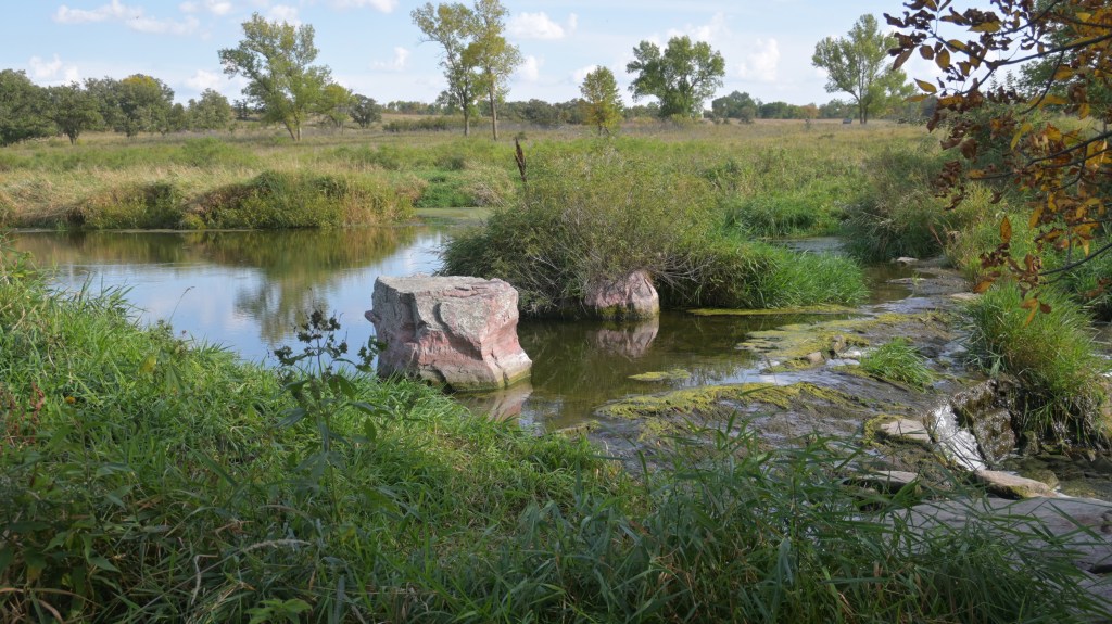
    A Sioux Quartzite boulder stands out on the tallgrass prairie
    A Sioux Quartzite boulder stands out on the tallgrass prairie – a hint of what lies below

    The Prairie

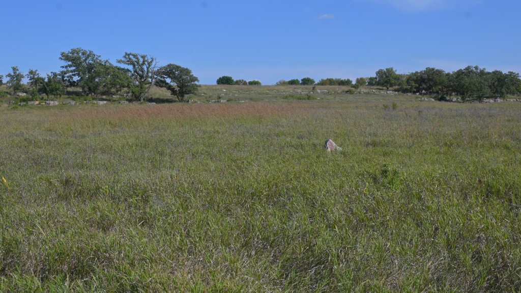
    The tallgrass prairie stretches across Pipestone National Monument, where tribes once gathered in peace to quarry the sacred red stone.
    The tallgrass prairie stretches across Pipestone National Monument, restored and managed to be just like it was back to pre- European settlers.

    The tallgrass prairie on this property is one of the remaining fragments of an ecosystem that once covered the vast open lands of our country. There are segments of prairie here that are original and native, with little change since prehistoric times. Other areas were recovered from agricultural plowing and restored to prairie. It is amazing to stand in this park and look out over a tallgrass prairie and experience what it was like centuries ago.

    Geology of Pipestone National Monument

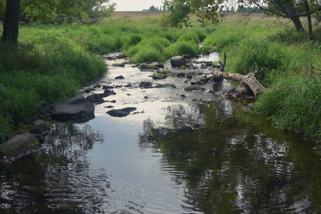
    Pipestone creek, a small tributary that runs through the monument, is responsible for eroding channels in the quartzite bedrock over thousands of years. The erosion eventually revealed a thin layer of metamorphosed red clay that lies between the quartzite. Pipestone creek is very picturesque and provides great opportunities for photography.

    Pipestone creek flows melodically through the prairies of Pipestone National Monument
    Pipestone creek flows melodically through the prairies of the park
    Pipestone creeks meanders through tallgrass prairie, exposing Sioux Quartzite boulders
    The creek meanders through tallgrass prairie, exposing Sioux Quartzite boulders.
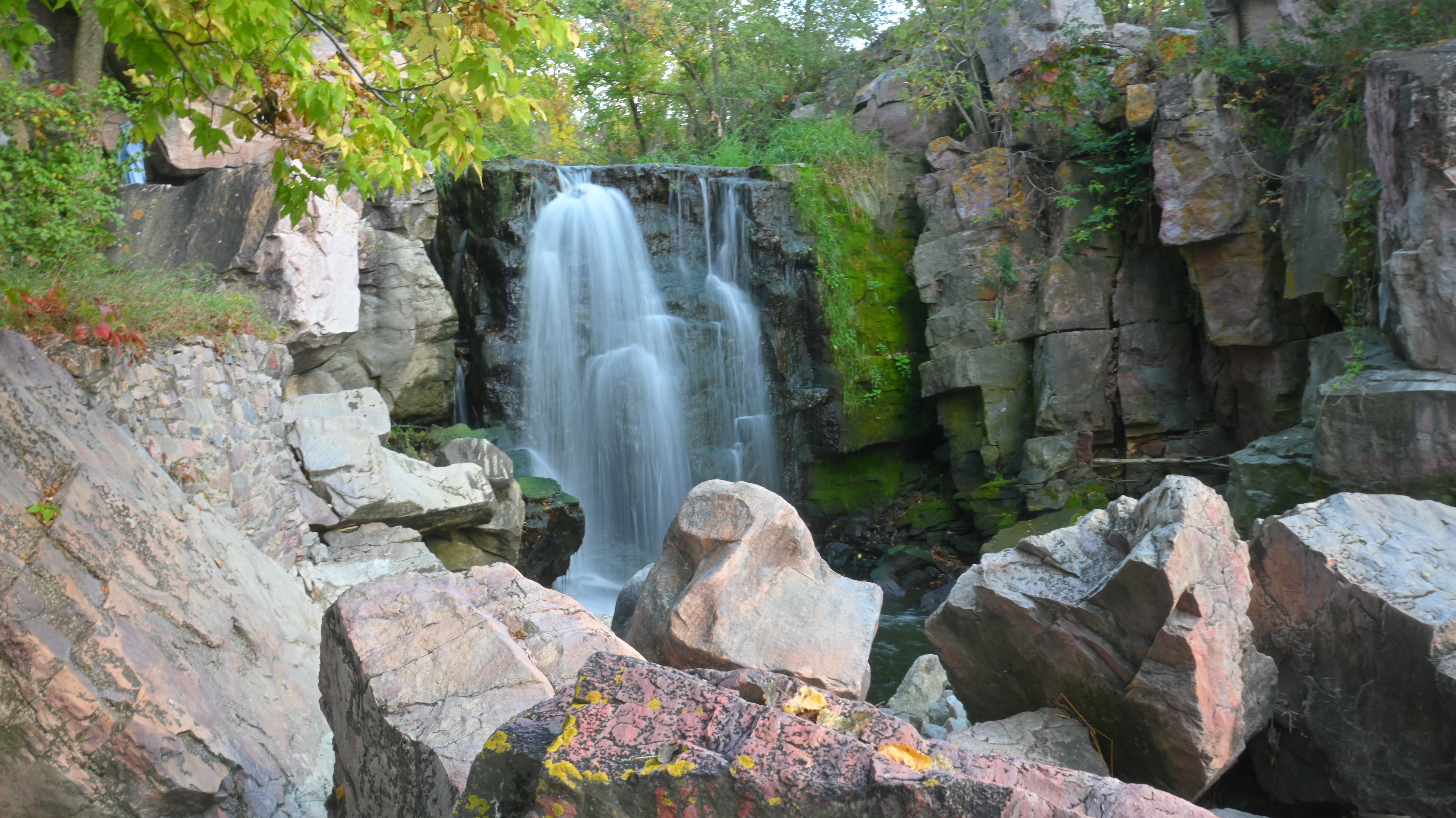
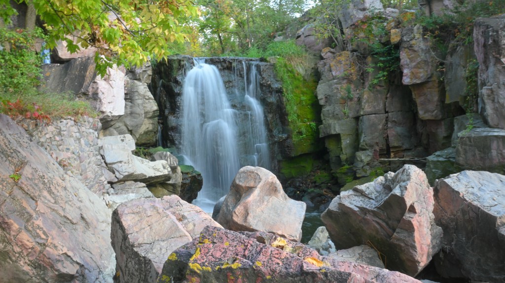
    Winnewissa Falls, flowing over ancient Sioux Quartzite, has long been a spiritual landmark and a place of offering.
    Winnewissa Falls – where Pipestone creek flows over ancient Sioux Quartzite, gives a spiritual voice to this sacred landmark of the Native peoples.

    The Rocks

    On the surface of the tallgrass prairie, glacial erratics are scattered about. Sioux quartzite (the second hardest rock on earth) shows itself in outcroppings and partially buried boulders. This is the bedrock of the area and is nearly 1.7 billions years old. Dozens of feet below the quartzite are the thin pipestone veins, sandwiched between massive quartzite beds.

    Exposed Sioux quartzite with thin layers of red pipestone, revealed by centuries of erosion from Pipestone Creek
    Exposed Sioux quartzite with thin layers of red pipestone, revealed by centuries of erosion from Pipestone Creek

    What exactly is Pipestone?

    Pipestone (also known as catlinite) is a reddish metamorphosed claystone found only in Pipestone National Monument. Its clay silt origin makes it relatively soft which means it can be worked with hand tools. The softness combined with great durability after being carved, makes it ideal for shaping into pipes and ceremonial objects.

    For centuries, Native American tribes have quarried pipestone by hand to create ceremonial pipes. The smoke from these pipes is believed to carry offerings to the Creator. Because of this deep meaning, the stone is regarded as a sacred gift and not just a raw material by Native peoples.

    A ceremonial pipe being carved from pipestone
    A ceremonial pipe being carved from pipestone. Public image from Wikimedia.

    Quarrying for Pipestone

    Tribes from across North America journeyed to the area now in the National Monument, including the Dakota, Lakota, Ojibwa, and others. The quarrying grounds were considered neutral territory where fighting was forbidden. Warriors had to lay their weapons down before entering the sacred grounds.

    This tradition continues today. The monument still allows quarrying by Native Americans who can trace their tribal affiliations. A permit is passed down through generations (much like Green Bay Packer tickets!) and families may spend their lives slowly working through layers of quartzite to reach a vein of pipestone below.

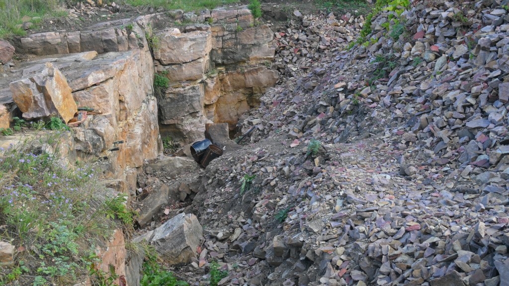
    Hand-hewn quarries where Native families still mine pipestone today. The work is done entirely by hand, without machines.
    Hand-hewn quarries where Native families still mine pipestone today. The work is done entirely by hand, no machines are permitted.
    .
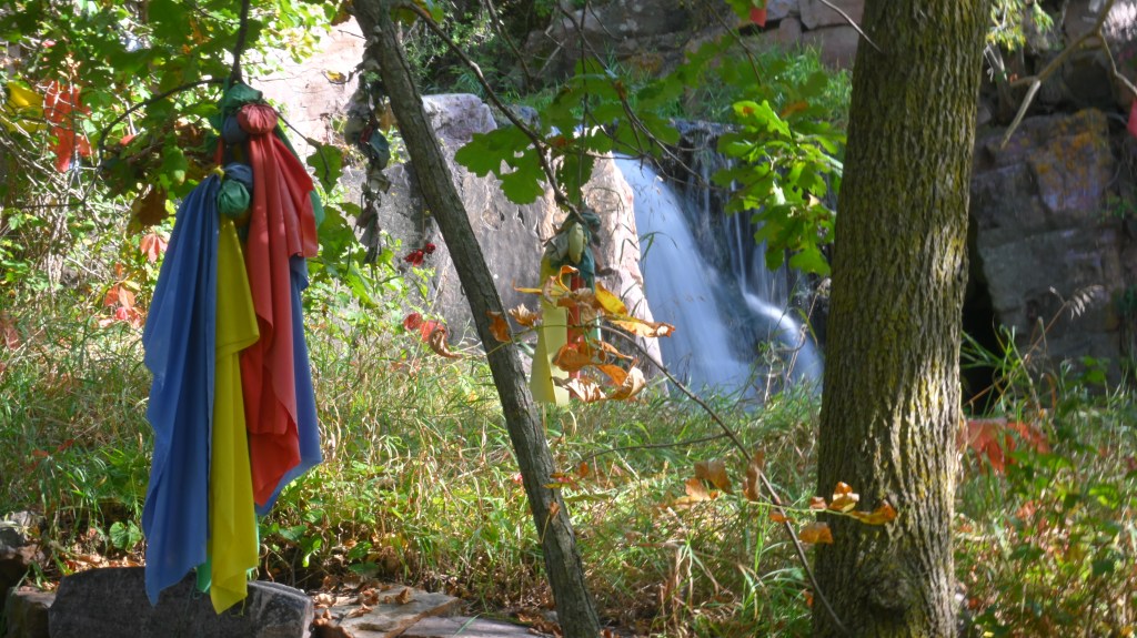
    Prayer cloths tied to trees flutter in the breeze, carrying prayers much like the smoke of the ceremonial pipe.
    Prayer cloths tied to trees flutter in the breeze, carrying prayers much like the smoke of the ceremonial pipe.

    Special treat for geology nerds!

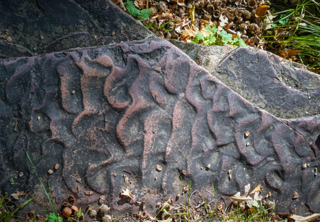
    Wave-like patterns on ancient stone in Pipestone National Monument

    These wave-like patterns in a rock along the trail at Pipestone National Monument are ripple marks; evidence of a shallow sea covering the area nearly 1.6 billion years ago. Over time, its sands became hard Sioux quartzite, and its clays transformed into the soft red pipestone. A small detail in a rock along the walking path, but a big clue to the geological processes that are responsible for the origin of Pipestone.

  • Foggy Morning Photos in Northern Wisconsin

    Foggy Morning Photos in Northern Wisconsin

    A 5-Mile Radius Photo Project

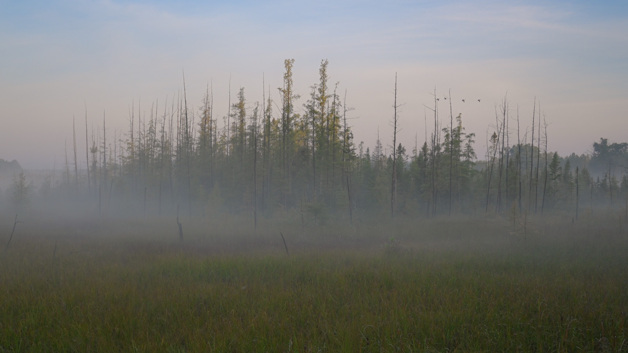
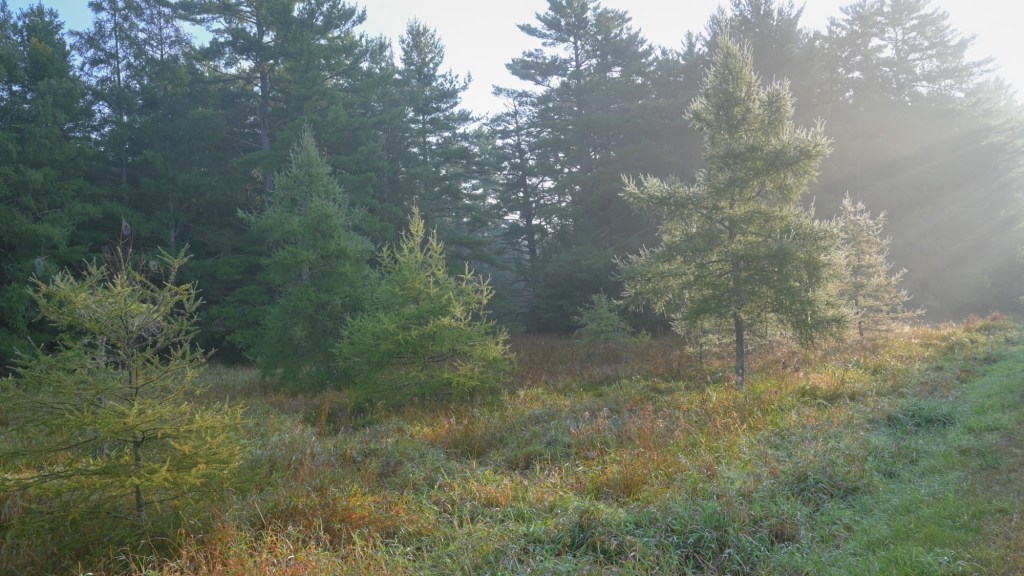
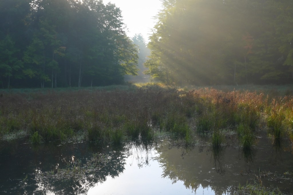
    To leave my house and go around the block is a 6.5-mile walk through quintessential post-glacial landscape. I woke up this morning to see beautiful rays of sunlight beaming diffusely through a light autumn fog. A perfect morning to take the camera for a walk. Welcome to our neighborhood!

    “An early-morning walk is a blessing for the whole day.” 

    — Henry David Thoreau

    Foggy Morning Photos

    *Click on images to expand

  • Pictured Rocks National Lakeshore

    Pictured Rocks National Lakeshore

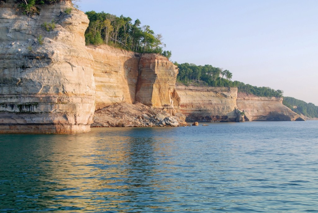
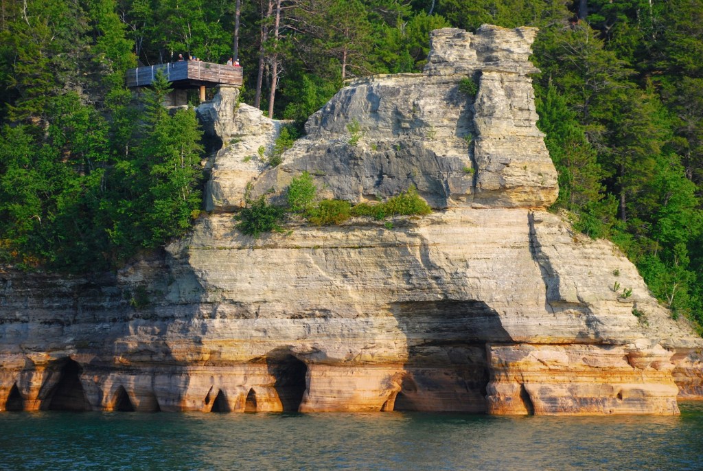
    Stretching for 42 miles along the southern shore of Lake Superior in Michigan’s Upper Peninsula, is a landscape carved by time, water, and wind. Towering sandstone cliffs rise dramatically above the turquoise waters of Lake Superior. The cliffs, are painted in layers of red, orange, green, and gold by mineral-rich groundwater seeping through the rock. The result is a geological canvas of color and texture. It constantly shifts as light plays off the moody waters of Lake Superior. It’s a dream location for photographers! And for all visitors, alike.

    • Note – All images in this post are “clickable”. Click on smaller images to view them larger. Click on larger images to view them smaller.
    Sandstone cliffs at Pictured Rocks National Lakeshore
    Sandstone cliffs glowing at sunrise
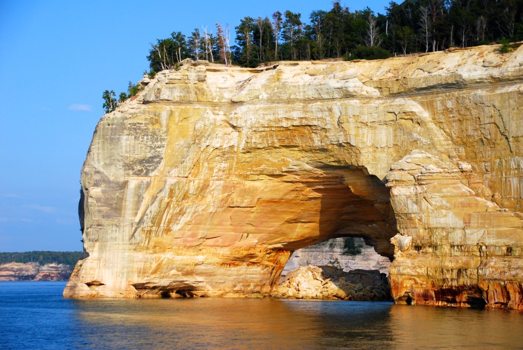
    Sea caves at Pictured Rocks National Lakeshore
    Sea caves at Pictured Rocks National Lakeshore
    Sandstone Rock Formations
    Carved by relentless waves, these cathedral-like arches echo with the voice of Lake Superior

    Designated as America’s first National Lakeshore in 1966, Pictured Rocks offers an amazing array of options for exploration. Whether arriving by hiking trail, kayak, or boat, the park invites you to slow down. Breathe in the crisp northern air. Take in the wild beauty of one of the Midwest’s most unique landscapes.

    The Boreal Forest

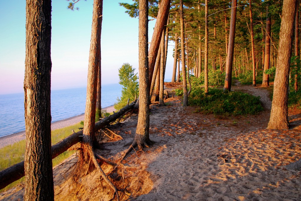
    Hiking trail along the Pictured Rocks National Lakeshore
    Golden evening light spills through the pines, tracing shadows across the sandy bluffs where forest


    meets lake.
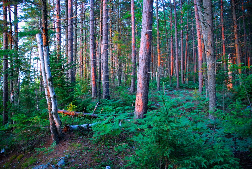
    A Boreal Forest frames the cliffs at Pictured Rocks National Lakeshore
    Inside the boreal forest, a fragrant world of spruce, birch, and shadowed understory thrives beneath the filtered northern light

    To Learn more about the boreal forest of Michigan’s Upper Peninsula, click, HERE.

    Sea Stacks, Rocks, and Waterfalls

    Rock formations at Pictured Rocks National Lakeshore
    Future sea stacks
    Large fallen rocks at Pictured Rocks National Lakeshore
    Large fallen rocks along the shoreline stand like a family waiting for the sunset
    Waterfalls at Pictured Rocks National Lakeshore
    From forest to stone to lake, cold streams plunge over sandstone ledges into the greatest of lakes

    Chapel Rock

    Chapel Rock.  A sea stack with 250 year old white pine tree with roots that reach back to the mainland

    Chapel Rock is a sandstone sea stack at Pictured Rocks. This iconic formation is adorned by a famous 250 years old white pine tree perched atop the stack. It continues to survive thanks to its remarkable roots. These roots reach back to the mainland even after the connecting arch collapsed in the 1940s!

    To visit this beacon of strength and determination in person, you can take the Chapel Rock and Chapel Beach Trail. It offers a scenic hiking experience. It is about a 6.2-mile round trip. An easy way to admire the park is from the water by kayak or boat tours.

    Geology of Pictured Rocks National Lakeshore

    Take a deep dive into the geological origins of this location, by clicking HERE.

    The image that earned a finalist position with the National Parks, Share the Experience, Photo Contest

    Kayakers along the colorful cliffs of Pictured Rocks National Lakeshore
    Chosen as one of the month’s best images by the National Park Service, this scene captures two kayakers surrounded by the amazing artistry of Pictured Rocks

    I never thought of this as the best image from the trip, but there is something special about it. Two kayakers share an unforgettable moment, dwarfed by the towering sandstone cliffs of Pictured Rocks. The vivid, vertical strokes of mineral-stained color flow behind them. It looks like nature’s abstract painting. The bright yellow kayak slices horizontally across the glowing water. It’s a bold contrast of motion against painted stone. I intentionally left out the skyline, causing the scene to feel immersive and timeless.

    I had no expectations when submitting the image to the National Park Service’s monthly photo selection. However, within a day, I received a reply containing a single word: “Beautiful.” 
    To my surprise, the photo was ultimately chosen as one of the best images of the month, joining a group of just 11 images selected from tens of thousands of submissions. The top three photographers earned handsome prizes. I received a one-year pass to all federal lands as a nice consolation.

    I wasn’t surprised or disappointed . The other winning images were extraordinary: high-quality, professional, National Geographic- looking. My photo wasn’t technically perfect, but it offered something unique. It showed a moment of two people sharing an unforgettable experience beneath one of America’s most striking landscapes, within an intriguing composition. For that reason, I think it punched above its weight class.


    Sunset from Pictured Rocks National Lakeshore

    Take some time to immerse in yourself in this image.

    Breathe. Relax. Dream. Go!

     A watercolor sunset over Lake Superior at Pictured Rocks National Lakeshore
    Evening settles over Lake Superior as fading sunlight radiates across calm water. Sky and water speaking for the setting sun

    Support

    Did you enjoy this post? Do you appreciate what I’m striving to accomplish with the photo essays and stories? If yes, I encourage you to subscribe below. Subscriptions help my site gain traction with a broader audience.

    Your information is encrypted and protected. I’ve declined all offers to advertise on this site.

    Thank you very much!

    Gary

  • Black & White

    Black & White

    A quick look at my Facebook page, Instagram feed, or the gallery on this website will show the vibrant colors in my photography. Most of my work lives in saturated color and strong contrasts. Often it feels like I see the world through a camera lens that has the image control set to vivid! Whether it’s the compliments on the color wheel or the soft golden glow of late-afternoon light, color influences how I interpret images. It shapes how I compose them.

    Knowing this, I sometimes force myself to go color blind when looking at composition, which changes everything.

    These six black and white photographs are selected from my travels. The stories are being told in form, light, shadows, and texture. Not bold, saturated colors. They offer a different, more contemplative way of seeing. We must process and interpret the delicate, subtle gradients of the in-between.

    The Images

    Goose Island on St. Mary's Lake - Glacier National Park
    Goose Island on St. Mary’s Lake – Glacier National Park
    Peshtigo Reef Light in a Storm, Green Bay of Lake Michigan
    Peshtigo Reef Light in a Storm
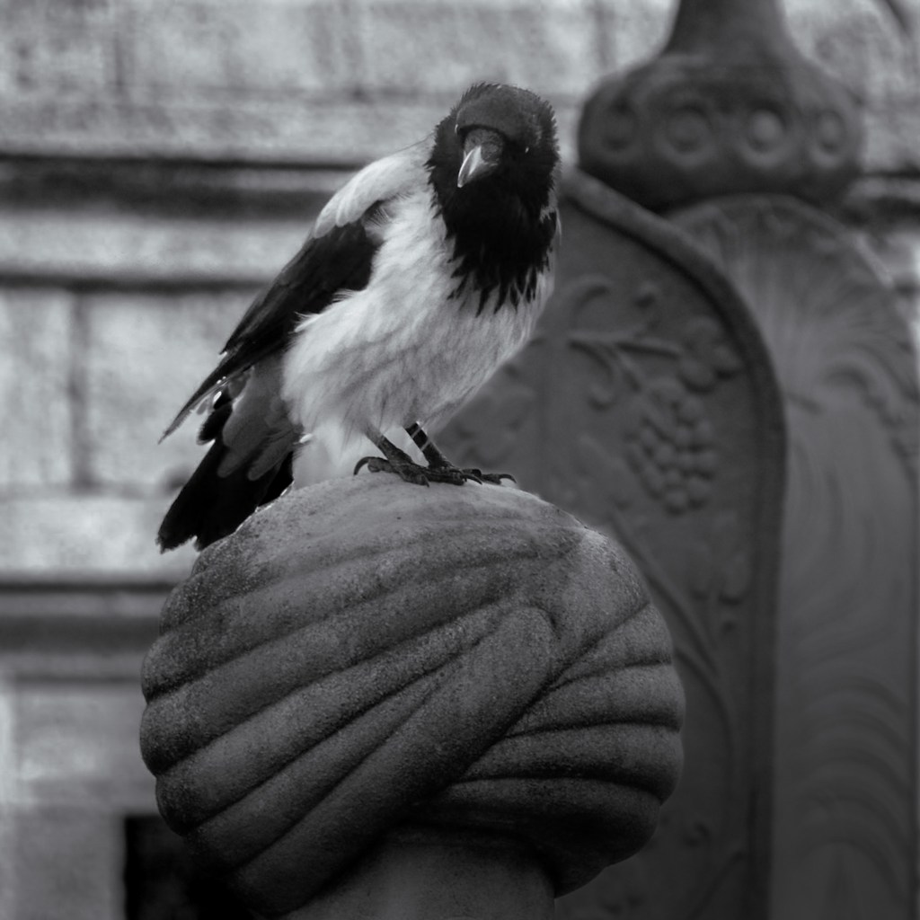
    Hooded Crow of Istanbul
    Hooded Crow of Istanbul
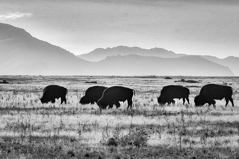
    Bison of Antelope Island, Great Salt Lake, Utah
    Bison of Antelope Island, Great Salt Lake, Utah
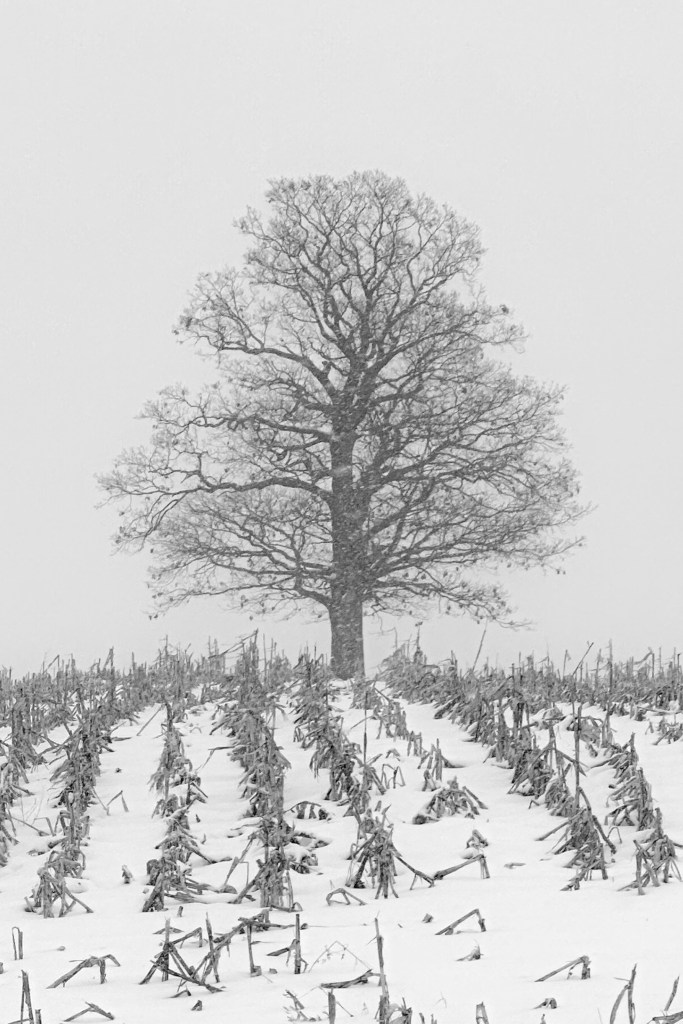
    Lone Oak in Cornfield, Northwest Wisconsin
    Lone Oak in Cornfield, Northwest Wisconsin
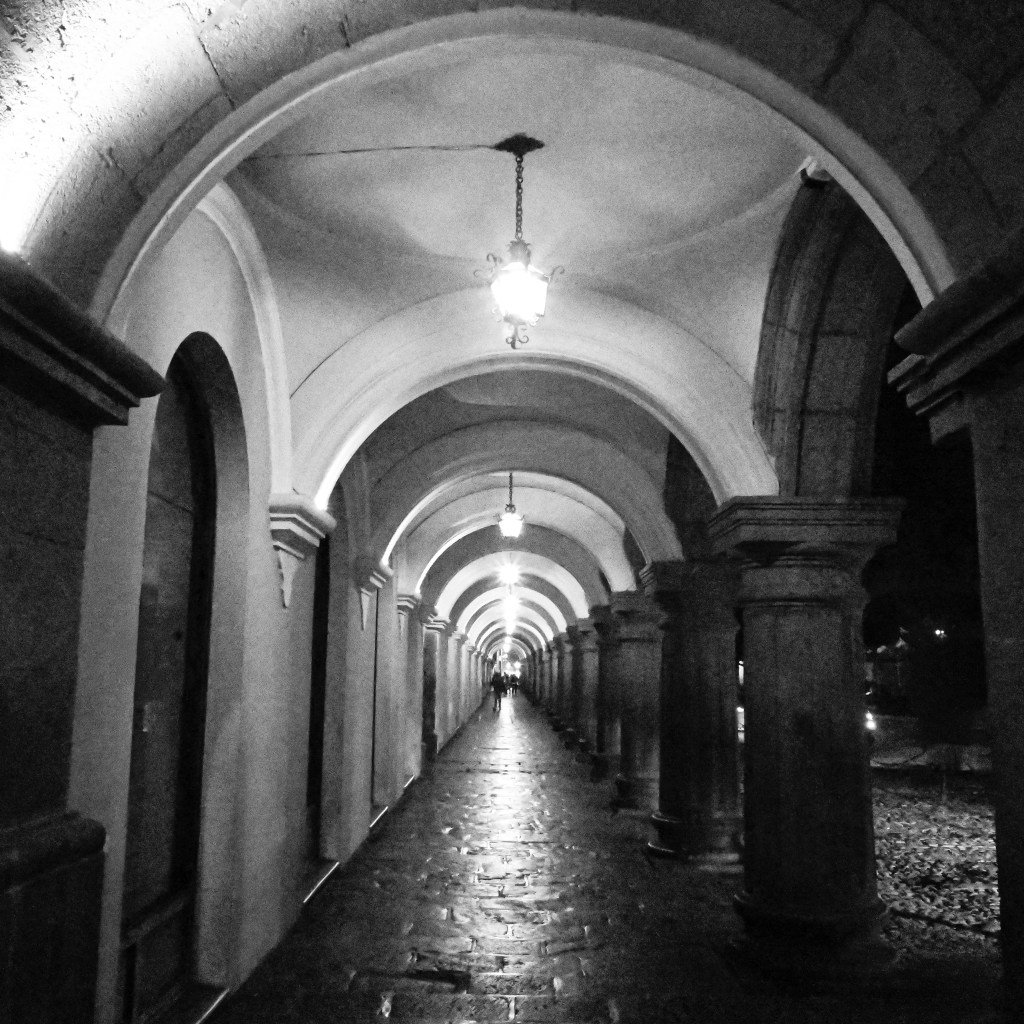
    La Antigua, Guatemala
    La Antigua, Guatemala

  • One Image – One Poem. A Collaboration Between Lifelong Friends

    One Image – One Poem. A Collaboration Between Lifelong Friends

    Forged in the wild, innocent years of childhood, some friendships endure, holding within them the memory of who we were and who we hoped to be. Others drift quietly away with the current of time.

    The friendships that last a lifetime are rare, and they are special. This collaboration is from such a friendship.

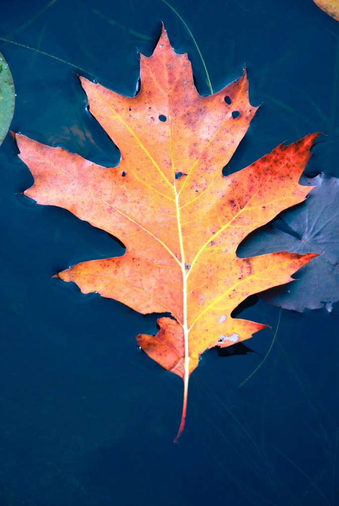
    This project began with a photograph. A single red oak leaf floats on still water. Simple, quiet, yet open to interpretation. I sent this photo to my friend, Tim Younce. He has always had a gift for words. I asked him to create a poem inspired by this image.

    What follows is the result. One image and one poem. A moment where camera and pen come together. Two lifelong friends unite their individual creativity for a single experience. Let us know what you think in a comment below.


    Red Oak Leaf on Pond

    Circling our pond,
    first time without you.
    A red leaf floats,
    never breaking surface tension.
    Reminding me, the world moves on.

    – By Tim Younce


  • The Biltmore Estate

    The Biltmore Estate

    Through the Lens of my Ricoh GR IIIx: A Day at the Biltmore Estate

    Stepping onto the grounds of the Biltmore Estate in Asheville, North Carolina, feels like opening the doors to a time machine and entering another world. Here, time melts away and history lingers in every stone, every garden path and thoughtfully designed mountain views.

    Built by George Washington Vanderbilt II in the late 1800s, The Biltmore still remains the largest privately owned home in the United States. It spans 175,000 square feet and is surrounded by 8,000 acres of forest, rolling hills, gardens, and vineyards.

    The Biltmore House

    The house itself is awe-inspiring. The French Renaissance chateau, completed in 1895, consists of 250 rooms, including 35 bedrooms and 43 bathrooms. It has 65 fireplaces. Each one is uniquely designed to match the purpose and style of the place. The front facade – seen in the featured image above is one of the most iconic facades in the world.

    The Banquet Hall was a highlight for me. It has a 70ft ceiling and an enormous triple fireplace. Towering chandeliers along with the family crest also define its grandeur.

    The main dining room in the Biltmore house
    The banquet hall in the Biltmore house

    Among the Gardens

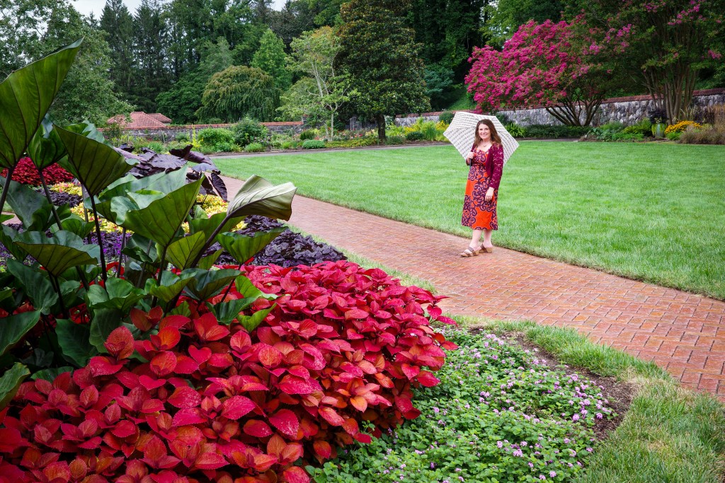
    The magnificent estate gardens are just a short stroll down a quiet path from the house. They were designed by the renowned landscape architect, Frederick Law Olmsted. Walking through these gardens is like stepping into a living painting. Jennifer and I wandered among the flowers under umbrellas, absorbing the saturated colors and fragrances, heightened by a summer rain shower.

    The garden cottage and gate are like something out of a dream! – Or a painting.

    The garden cottage and gate on the Biltmore Estate
    The garden cottage and gate on the Biltmore Estate

    The Conservatory

    Providing the backdrop to the beautiful gardens is the Conservatory. Walking through the doors of the Conservatory is an immersive experience. It’s like transitioning from the rolling hills of the Biltmore into a lush, vibrant jungle. Tropical palms stretch towards the skylights while flowering vines and plants from all imagination spill down from dew-soaked wooden beams. The spectrum of colors and textures seem almost surreal. The Ricoh handled the colors and dreamy, soft light beautifully.

    Sweeping views of the Estate

    From terraces on the estate, the views open up to rolling meadows where trees seem placed by a landscape painter. In the distance, the cloud draped Blue Ridge Mountains become a majestic frame. It’s here that you can get a sense of the scale of Vanderbilt’s vision. To blend nature, architecture, and art into one harmonious experience.

    The Inn at Biltmore Estate

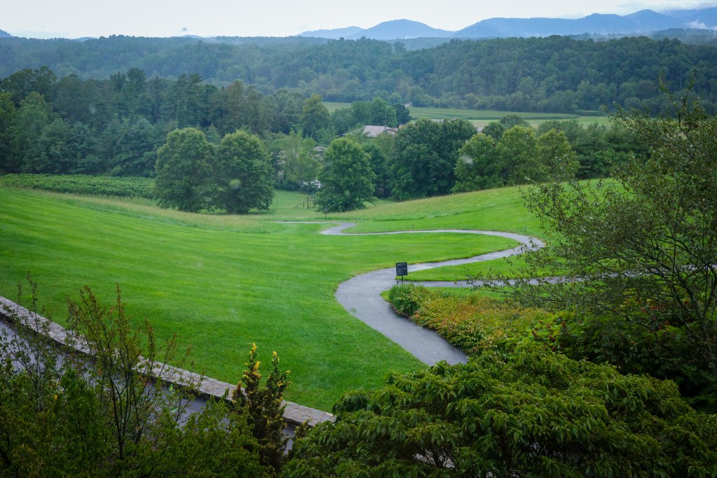
    The final landscape photograph is a view from the Inn at Biltmore Estate. The Inn feels like a natural extension of the grounds. It’s elegant and quiet. There are places to rest and reflect. Places to sit still and appreciate the natural beauty that provides the foundation for this truly amazing place. An evening mist lifts from the verdant forests of the Blue Ridge Mountains. Mother Nature sighing a relief after a long day.

    View of the Blue Ridge Mountains from the Inn at the Biltmore Estate

    The View of the Blue Ridge Mountains from the Inn at Biltmore Estate

    An enchanting meal at the Inn

    We concluded this magical day with an inviting dinner at The Dining Room, nestled within the Inn. The Dining Room at The Inn at Biltmore Estate has celebrated a Four-Star rating from Forbes Travel Guide for eight consecutive years through 2025. It consistently receives the Wine Spectator ‘award of Excellence. The menu reflects a “field-to-table” philosophy with much of the food coming from the estate itself. The dishes can be paired with wines from the Biltmore’s own vineyard.

    Out of respect for the decorum of peacefulness and privacy at the Dining Room, I refrained from taking photos. I wanted to maintain the ambiance of our dining experience. However, the view from our table was the same as the above image.

    Photographing the Biltmore Estate with the Ricoh Gr IIIx

    The Ricoh GR cameras are often described as street photography cameras. However, they certainly shouldn’t be pigeonholed. For me, it has become a great travel companion. Its compact size makes it ideal for places like Biltmore where large cameras and bulky lenses are discouraged. The exceptional image quality and color rendering are impressive. Being able to shoot high quality images quickly and quietly without drawing attention made the experience more immersive for me. I could focus on seeing and instead of managing gear.

    The Biltmore Estate is much more than its iconic facade and enormous size. It’s an invitation to wander and linger. Experience history and architecture. Enjoy art and nature in all their beauty in one extraordinary place.

    Site Icon

    Go Further

    For more information on The Biltmore Estate, Check out their excellent website HERE.

    For more information on Ricoh Cameras, click HERE.


— Anthony Bourdain