Exploring the Intersection of Photography, Nature, and Travel
Custer State Park and the Black Hills of South Dakota
Words and Photography by Gary Donaldson
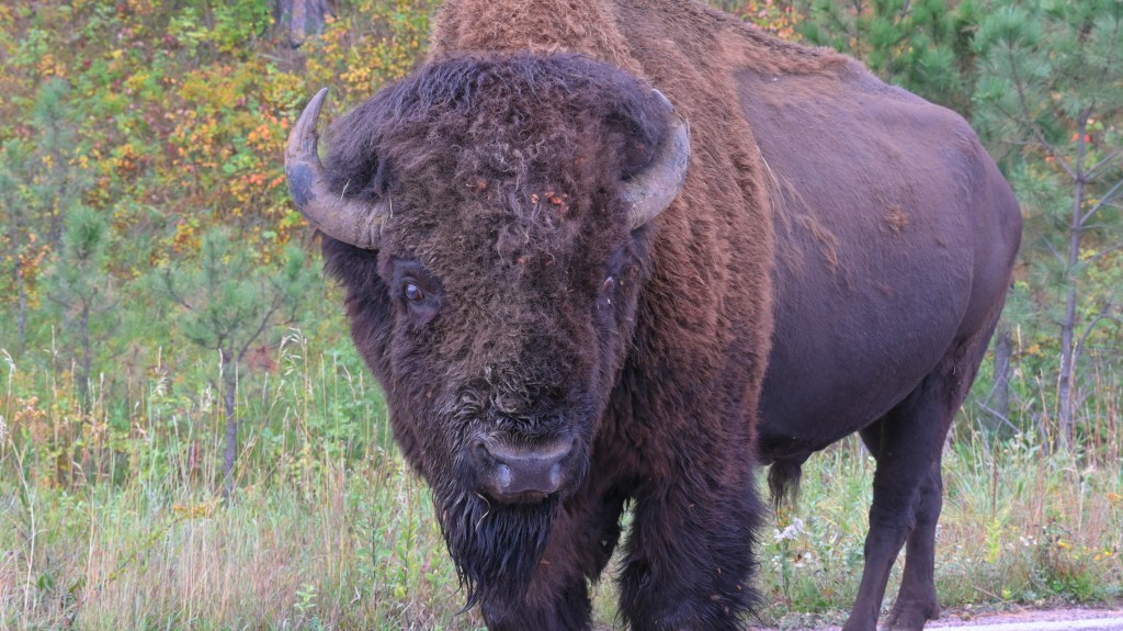
Over two billion years ago, the landscape we know as the Black Hills began deep in the earth’s crust. A gigantic bubble of molten rock (magma), roughly the size of Connecticut, slowly cooled into granite. The granite locked in minerals like quartz, feldspar, and mica. For millions of years it lay buried under ancient seas. Then, powerful forces within the earth shoved the granite mass (a batholith) upwards like a piston, folding and cracking the top layers of land to form the dome of the Black Hills.
Over geological time (millions of years), wind, rain, and ice eroded the softer sedimentary layers away, revealing the granite and other hard minerals. Erosion continued in the folds and cracks of the granite. Eventually sculpting the landscape into what we see today in Custer State Park and the Black Hills of South Dakota.
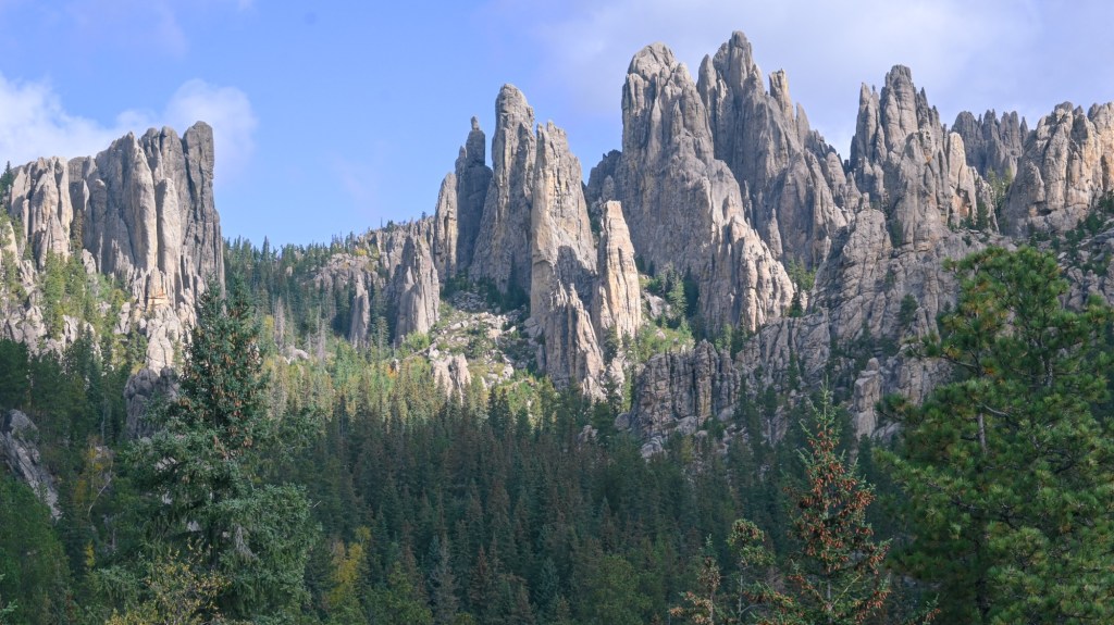
Towering Spires
The Needles Highway in Custer State Park winds its way through towering granite spires.
* Click on images below to expand (desktop & laptop).
These jointed granite columns rise like organ pipes above the Ponderosa Pines of the Black Hills. Weathering along fractures create sharp vertical walls and narrow corridors.
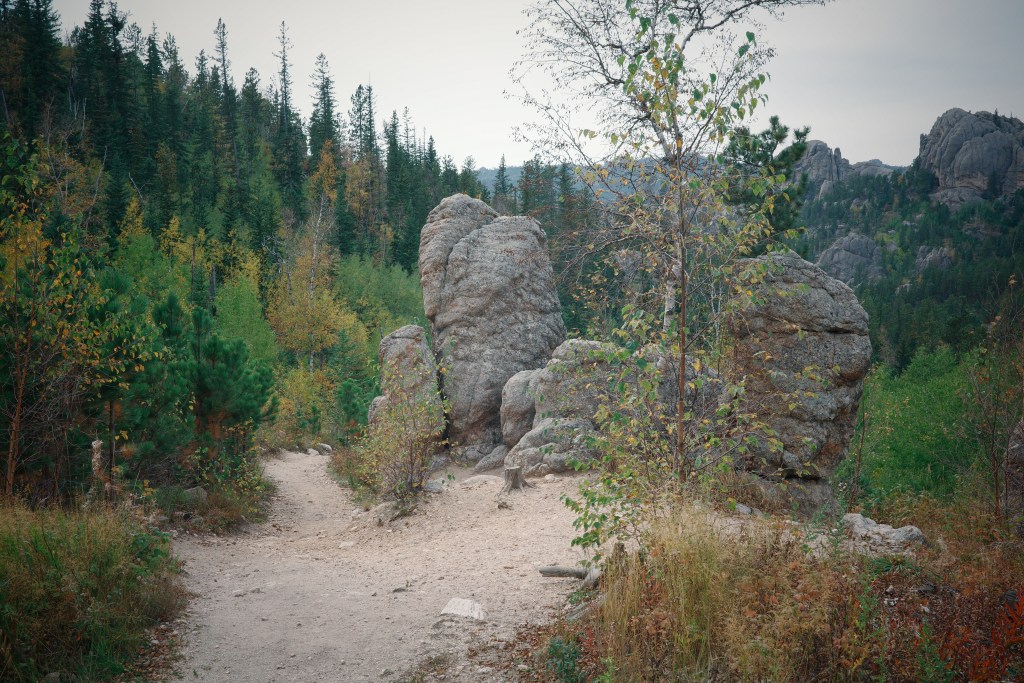
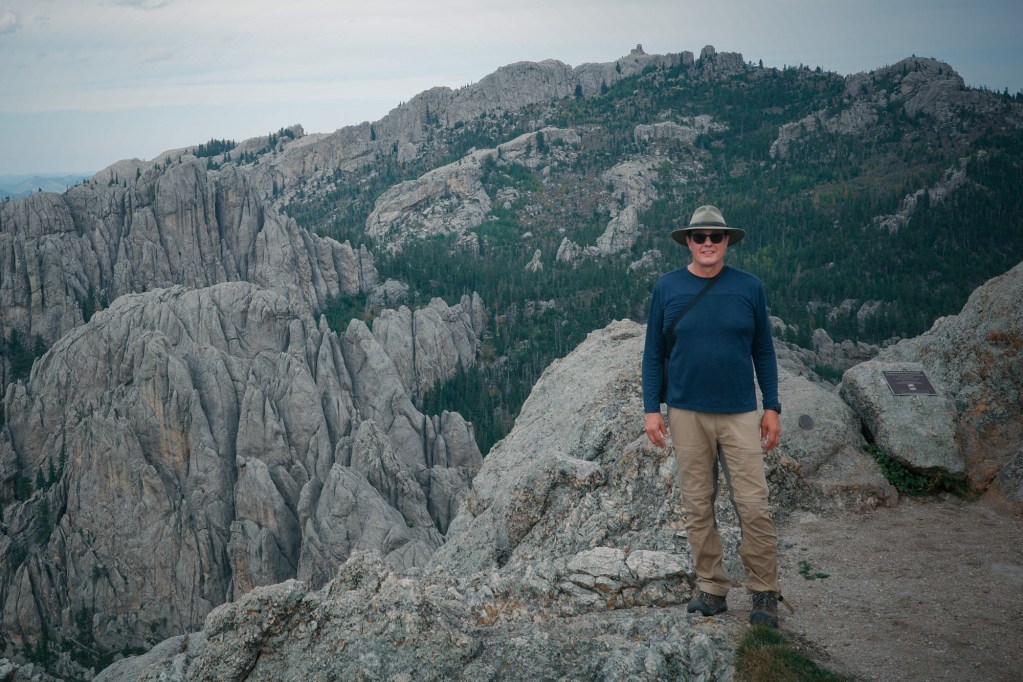
A Hike to the Geological Center of the Dome
Fall colors line the trail to Little Devil’s Tower. The upper section of the trail is sprinkled with mica that sparkle like tiny diamonds.I’m standing on the summit of Little Devil’s Tower (6,959ft). Behind me is the highest point in the U.S. east of the Rocky Mountains. At 7,244ft, Black Elk Peak is the crown of the granite batholith, shoved up from earth’s crust to form the core of the Black Hills uplift.These cathedral-like spires are remnants of the Granite batholith. Sculpted by millions of years of weathering, leaving behind the jagged skyline that defines the central Black Hills.
Icons of the Black Hills
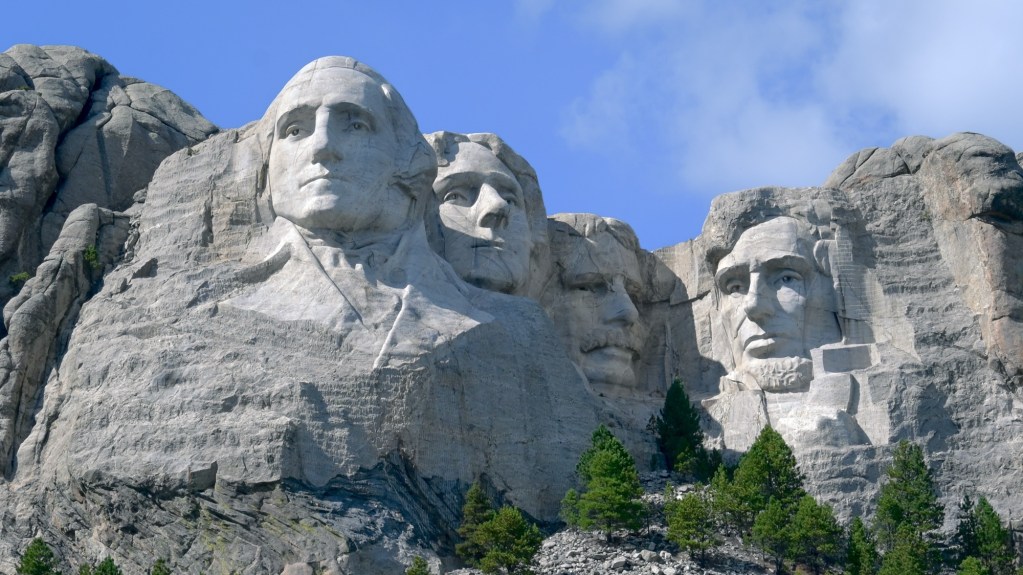
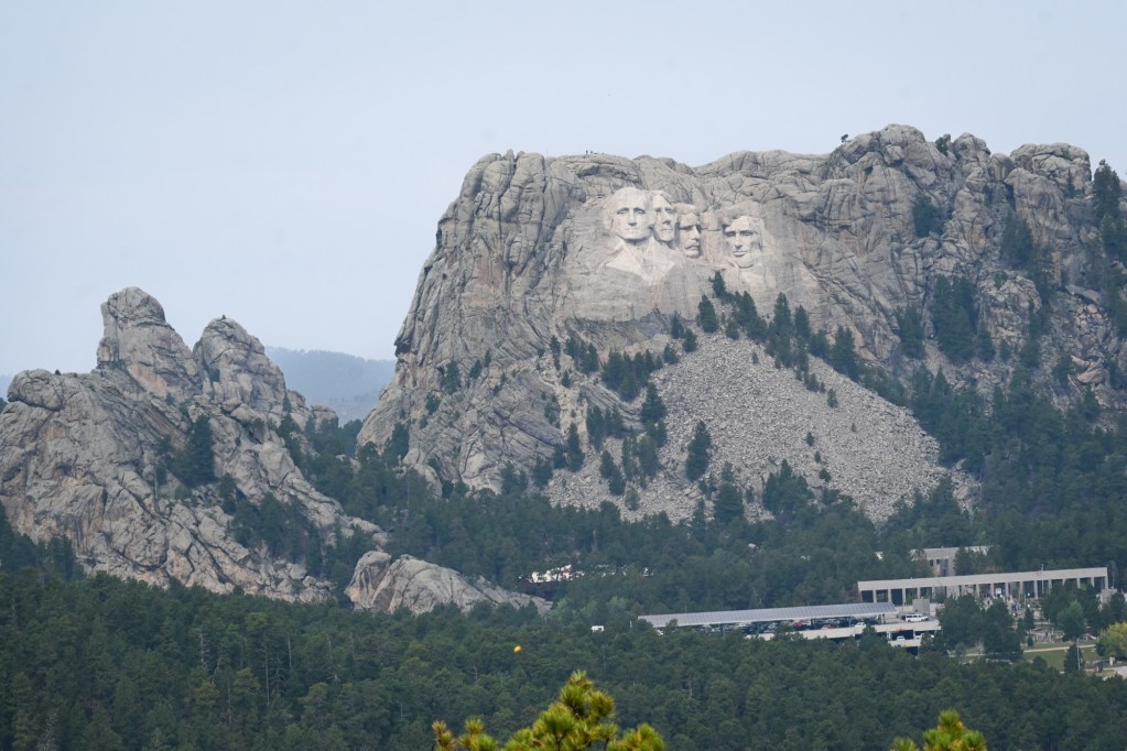
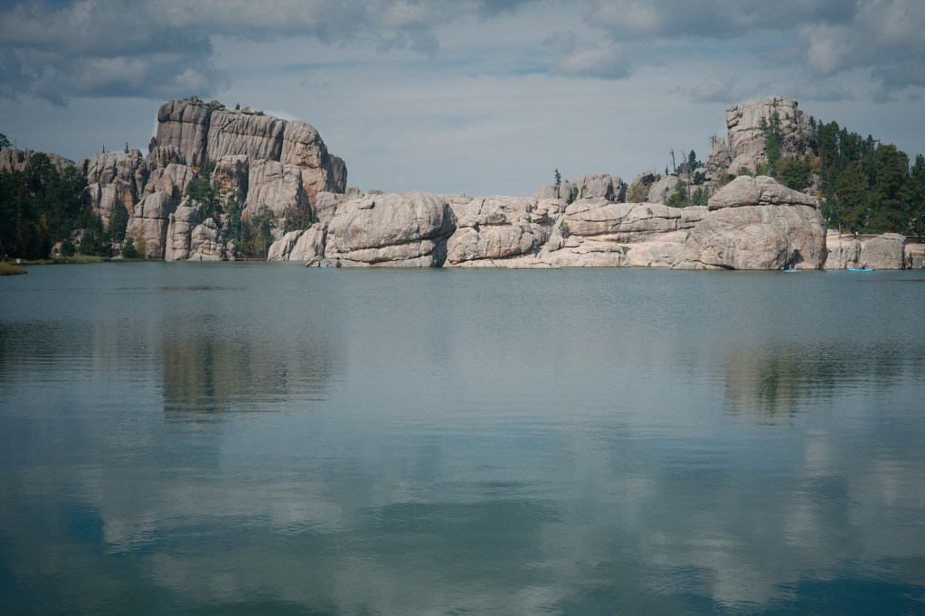
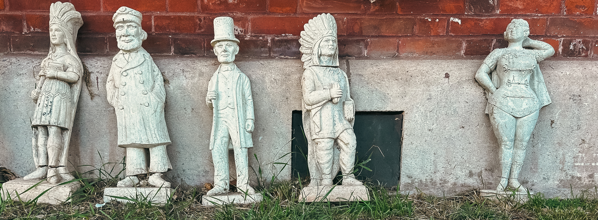
Mount Rushmore – The sculpture is carved directly into Precambrian granite along with veins of quartz and feldspar (seen here as lighter streaks across the forehead of Lincoln).Mount Rushmore rises from the same 1.7 billion-year-old granite peaks seen throughout Custer State Park.The rounded cliffs at iconic Sylvan Lake are domes of granite, lifted and exfoliated bare. Sylvan Lake is the most photographed location in Custer State Park.
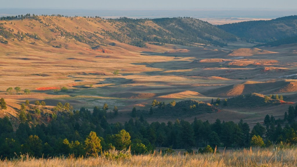
Picturesque Rolling Hills and Prairies in the Outer Rings of the Black Hills.
The “outer rings” of the Black Hills display eroded layers of rust-colored sandstone and shale deposited in a shallow inland sea that once covered the entire area.Erosion of the Black Hills continues. One Tree Hill (nod to U2). Last light over the Black Hills.
“The first peace, which is the most important, is that which comes within the souls of people when they realize their relationship, their oneness with the universe and all its powers…” — Black Elk (Oglala Lakota)
Stay tuned for more posts from the Black Hills and Custer State Park.
Quilotoa, Ecuador, a remote village high in the Andes mountains seen through three cameras, each offering a different way of capturing place, presence, and moment.
FIELD NOTES: On cobblestone streets in the historic center of Quito, stands an ancient wooden door. And no matter what awaits beyond, you must reach for a hand to cross the threshold. It offers no invitation. Closed to the passive. Quietly indifferent for centuries. Yet it has been reached for many times, polishing the brass…
Field Notes We pulled into the parking lot of a restaurant. An old brick building that used to be a train station, but now serves the best pizza in town. On the way to the door, I noticed them. Already in line. Not a word between them. No shifting of feet. No second thoughts. Just


This blog is a place for stories and conversations. Add your voice below – I'd love to hear it.