A lone hiker stands atop a rocky outcrop overlooking the rugged landscape of Antelope Island and the hazy waters of the Great Salt Lake in Utah.

Author: Gary Donaldson

  • Photographing Quilotoa, Ecuador

    Photographing Quilotoa, Ecuador

    Three Cameras, One Story

    At 13,000ft, the air thins and the land opens. There is a clear sense of standing on top of the Andes. Mountains below. Everything else is sky.

    Quilotoa doesn’t announce itself. After hours of winding up and up, it suddenly appears. Like reaching the apex of the first ascent on a roller coster. Up here the elements gather. Wind and water, earth and sky, held together within the rim of an ancient crater.

    I had three cameras on this trip, allowing me to see and share this amazing place in different ways.

    iPhone

    Let’s begin with the simplest lens. The one we carry without thinking.

    The opening image of the Quilotoa crater was taken with my iPhone – not because I believed it would outperform the Nikon Z6III or the Ricoh GR IIIx, but because it was the only camera I had with me at that moment.

    I was in Quilotoa with the Denver, Colorado Lions Club, helping fit eyeglasses for people in this remote Kichwa village. Essentially, kind gestures collected from across the United States. I was walking toward our lunch stop when someone approached with an urgent message.

    “The clouds have cleared. You can see the crater lake right now!”

    In the Andes, moments like this are never guaranteed. They come and go in minutes.

    My mind ran a quick inventory.

    Nikon-on the bus.

    Ricoh-on the bus.

    iPhone-in my pocket.

    This is the strength of a mobile phone in travel photography. It is not always the best camera in terms of optics or control, but it is often the best camera simply because it is there.

    So often, the most meaningful images are not planned or choreographed. They present themselves in an instant. As travelers, we have to be aware of these moments and respond with whatever camera is available at the time.
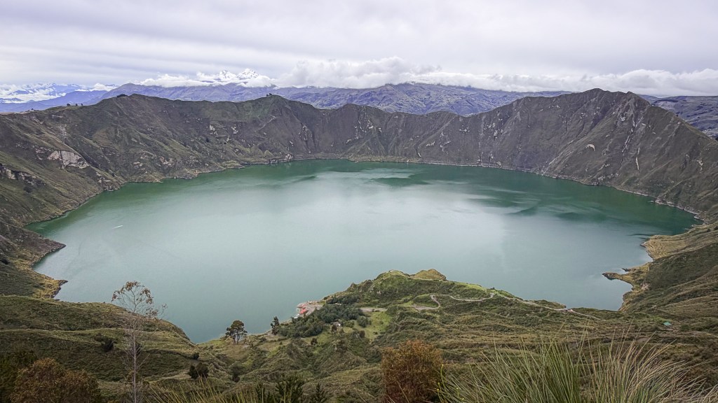
    High in the Ecuadorian Andes, the emerald waters of Quilotoa crater lake rest within a volcanic caldera, shaped by time, altitude, and weather.

    With my iPhone, I captured this sweeping panorama of the Quilotoa crater lake, the surrounding ridge lines, and distant, snow-covered, volcanic peaks.

    The Ricoh GRlllx

    Then there is the Ricoh GR IIIx. A camera few people seem to know, yet for those who do, it becomes a traveling companion.

    The camera shares a heritage with Pentax. the GR series was designed with street photographers in mind. It is truly a compact camera – barely larger than a deck of cards. But don’t let size fool you, within the small frame is something extraordinary. It has a large sensor paired with a sharp, fixed lens engineered precisely for this singular camera. It feels more like a fine instrument than a gadget for taking pictures.

    This is the camera I reach for when discretion matters. It has no viewfinder. No reason to raise it to your eye and become a tourist instead of a traveler.

    I hold it at chest level, composing on instincts, pressing the shutter button mostly unnoticed. focal lengths are predetermined. Moments remain true. No awkward smiles. No posing, and no disapproving glares. Just life as I see it.

    I also choose the Ricoh when I want to travel lightly. When the intention is to walk, to dine, to visit… Anything but photography. The Nikon stays behind. The Ricoh slips into a pocket. No bag. No weight. And no regrets.

    The two images below were captured using the Ricoh GRlllx in Quilotoa.

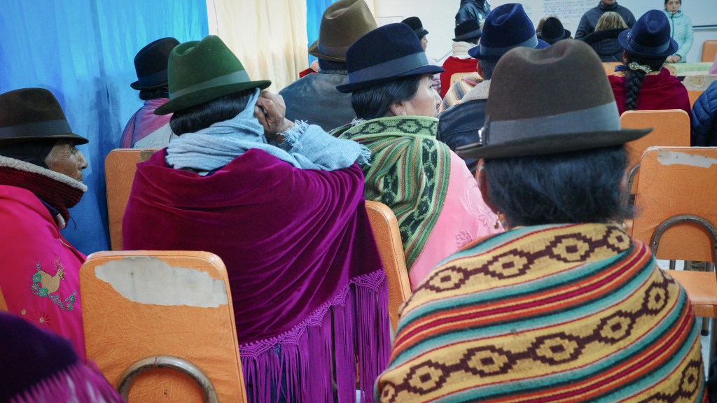
    Inside a village building above Quilotoa crater lake, Kichwa community members gather for a meeting with visiting volunteers. Woven textiles and felt hats create a vivid tapestry of color in the high Andes.
    Members of a high Andes Kichwa community gather outside a community building. At this altitude, layered wool shawls and felt hats offer both warmth and a sense of tradition.
    Inside a village building above Quilotoa crater lake, Kichwa community members gather for a meeting with visiting volunteers. Woven textiles and felt hats create a vivid tapestry of color in the high Andes.
    Inside the building, community members gather for a meeting with visiting volunteers. The Ricoh GRlllx handles the colorful array of textiles brilliantly.

    The Nikon Z6lll

    Finally, we arrive at the Nikon Z6lll. This is a camera that doesn’t need to prove itself. It is a confident and capable instrument, designed not to just record a scene, but to interpret it with intense clarity and depth. Light is rendered with all of its nuances. Details hold together, even at a distance.

    You carry this camera with a purpose. The menus read like a personality test – inviting the owner to create a unique style of photography. This is how I see the world. This is how I want to share it with you.

    Just before departing Quitoloa, I hurriedly pulled the Nikon Z6lll off the bus and walked a few hundred feet down the main street of this little village in the Andes. I snapped three photos. One of which is presented below. Here, the Nikon was paired with the Nikkor Z 24-120mm f/4 S lens. An amazingly versatile lens for travel photography. At 24mm it opens wide and allows the scene to breathe, to establish place and scale. At 120mm, reaches into the scene, drawing elements forward while isolating details and clarifying textures.
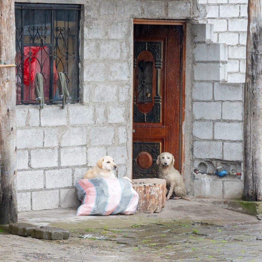
    Outside a village home near Quilotoa crater lake, two dogs linger by the doorway on a rainy afternoon in the Ecuadorian Andes.
    Along a street of cobblestone and mud, two dogs linger by a doorway on a rainy afternoon in the Ecuadorian Andes.

    Click on the image below for a close up
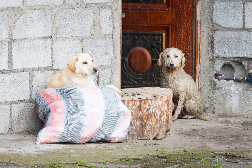
    Outside a village home near Quilotoa crater lake, two dogs linger by the doorway on a rainy afternoon in the Ecuadorian Andes.

    The results here are not simply photographs of a place, but a composition of its elements that begin to suggest its character. A step toward capturing the essence of a place, and presenting images that reflect the emotional response of the moment.


    Site Icon
  • Passage

    Passage

    Field Notes:

    On a cobblestone street in the historic center of Quito, stands an ancient wooden door. And no matter what awaits beyond, you must reach for a hand to cross the threshold. It offers no invitation. Closed to the passive. Quietly indifferent for centuries.

    Yet it has been reached for many times, polishing the brass to a warm glow. The quiet alchemy of human touch.

    Go seek the unknown
    Stroll streets of foreign cities
    Open doors within


    Site Icon

  • Waiting for a Table

    Waiting for a Table

    We pulled into the parking lot of a restaurant. An old brick building that used to be a train station, but now serves the best pizza in town.

    On the way to the door, I noticed them. Already in line. Not a word between them. No shifting of feet. No second thoughts. Just waiting.

    They say you can judge
    a restaurant by the line
    waiting out front—
    if there’s any truth to it
    I can’t wait to try the pizza


    Site Icon
  • The Historic Center of Quito, Ecuador

    The Historic Center of Quito, Ecuador

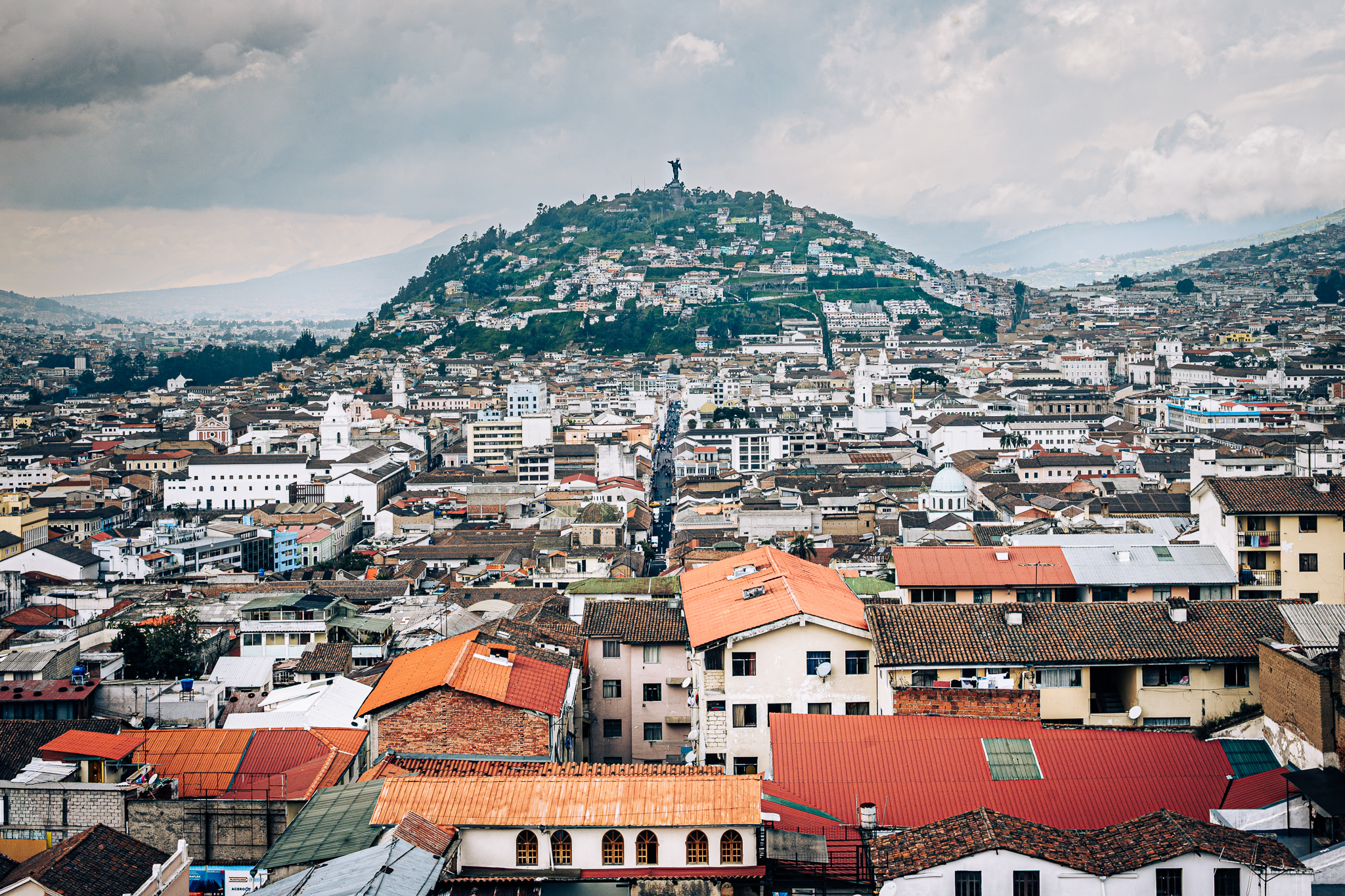
    From a balcony of the great Basilica, the city rises toward El Panecillo. Here the Virgin overlooks the historic center of Quito, and beyond. At nearly 9,400 feet, Ecuador’s capital sits higher than any other capital in the world. Yet this modest hill carries a presence far beyond its scale for the residents of this city atop the Andes.

    Basílica del Voto Nacional

    The Basílica del Voto National in Quito.  Panecillo and the statue of the Virgin is in the background

    Framed by the twin towers of the Basílica del Voto Nacional, Quito extends outward beneath a heavy sky. Beyond the cathedral, El Panecillo rises at the city’s center, where the Virgin stands in the distance. Two religious presences of Quito held within a single frame.

    A quiet procession beneath stone and light—two figures walk the central aisle of Quito’s great cathedral, dwarfed by soaring arches and stained glass that lifts the eye toward the heavens.

    A solemn procession. Two figures walk the central aisle of Quito’s iconic cathedral. Soaring symmetrical arches and stained glass windows lift the eye toward the heavens, just as the original architect designed.

    A street in the historic district of Quito with the Basílica del Voto National in the distance

    A rain-darkened street leads our eye through Quito’s historic center, where the twin towers of the Basílica del Voto Nacional beckon at the far end.

    Domes of the Church La Compañía

    A quiet plaza under gathering clouds—the fountain anchors the square as the tiled dome of La Compañía rises beyond, catching a brief break of light above Quito’s historic heart.

    A fountain anchors the plaza of San Francisco. The tiled domes of La Compañía rise a block beyond as afternoon rain clouds gather.

    Inside the Church of La Campañía de Jesus

    Inside the Catholic Church, La Compañía, a rich ornamentation of gold sheeting and a starry dome is on display in the baroque architectural style. Pope John Paul II presided over mass here in 1985. Pope Francis stopped to pray here in a visit to Ecuador in 2015.

    The Plaza of San Francisco

    The plaza of San Francisco at night. The Panecillo and the Virgin Mary light up the background

    During the day, the historic center of Quito is bustling with people moving with intention. However, as night settles on the city, people gather on the plaza to rest, visit, and enjoy the best of what Quito has to offer. Like shops offering rich Ecuadorian coffee and world-famous local chocolates and ice cream. I took this photo from the second story balcony of such a shop. I enjoyed this view nearly every evening during my stay in Quito. 😁


    Site Icon
  • Photographing the Mindo Cloud Forest of Ecuador: Mist, Birds, and Waterfalls

    Photographing the Mindo Cloud Forest of Ecuador: Mist, Birds, and Waterfalls

    A few hours northwest of Quito, on the western slopes of the Andes, lies the Mindo Cloud Forest. Here, between 4,000ft to 6,000ft above sea level, the forested mountains dissolve into the clouds in one of the most biologically rich ecosystems on earth.

    Warm, moisture-filled air rises from the pacific coast lowlands and condenses against the cool mountain vegetation. This creates a near-constant veil of clouds that feeds a truly extraordinary abundance of life.

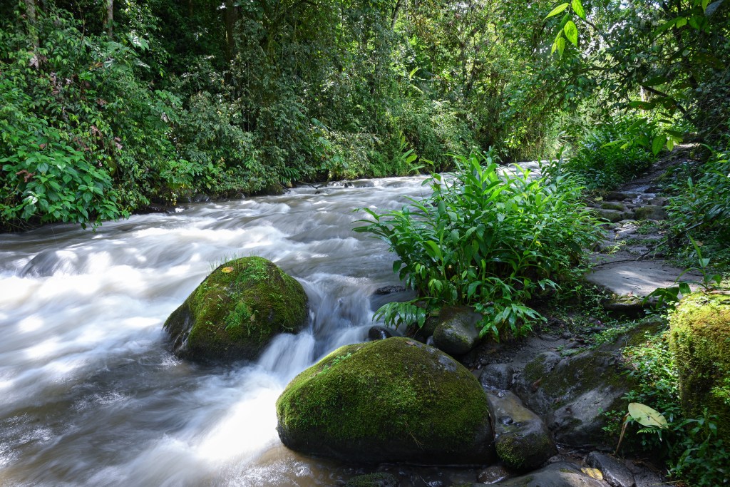
    The Quebrada Santa Rosa River flows through the valley of the Mindo Cloud Forest
    The Quebrada Santa Rosa River flows through the valleys near Mindo.

    Water is everywhere in the Mindo Cloud Forest. It trickles down nearly every inside turn on a trail. It seeps from beneath rocks and logs. Every step is on moist ground. Moss clings to every surface. You can taste the tropical air in every breath.

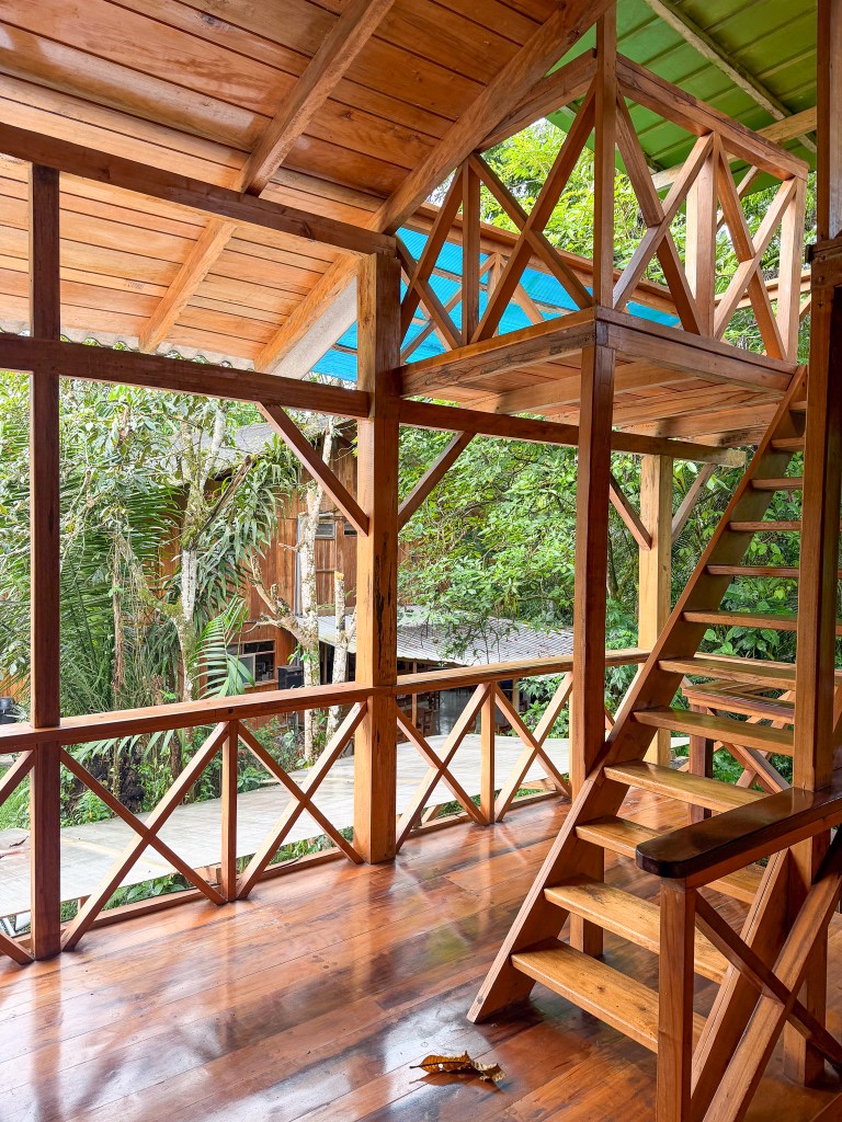
    Overnight at an Ecolodge

    In Mindo, the best time for birding is during the soft light of early morning and late evening. Alternatively, the best time for site-seeing and hiking is midday when the sun’s warmth pulls back the curtain of clouds.

    To accommodate this schedule, It’s a good idea to include at least one overnight stay when planning a visit here.

    An Ecolodge in the town of Mindo, Ecuador

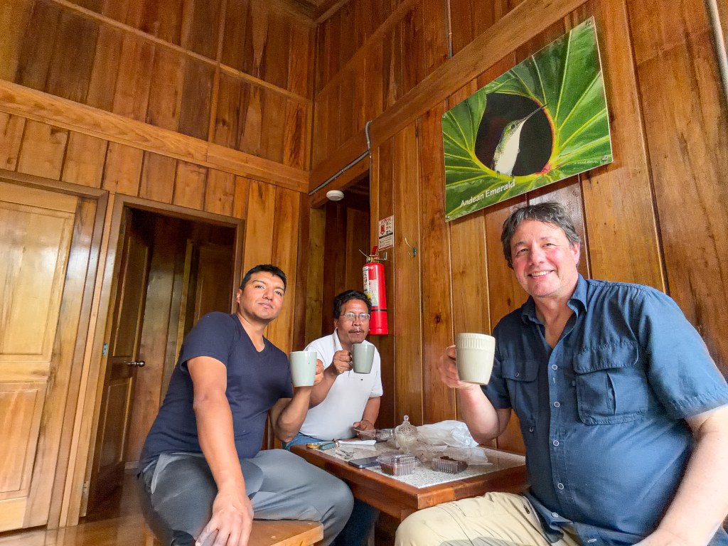
    It also allows for downtime with friends. The images below show, Marlon, the guide, James, our driver, and me, savoring cups of locally grown coffee on the porch while snacking on brownies made with Ecuadorian chocolate.

    Birding in Mindo’s cloud forest

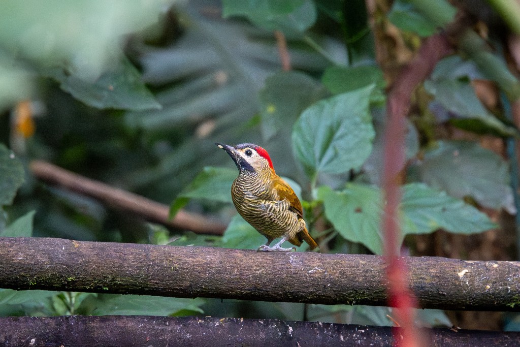
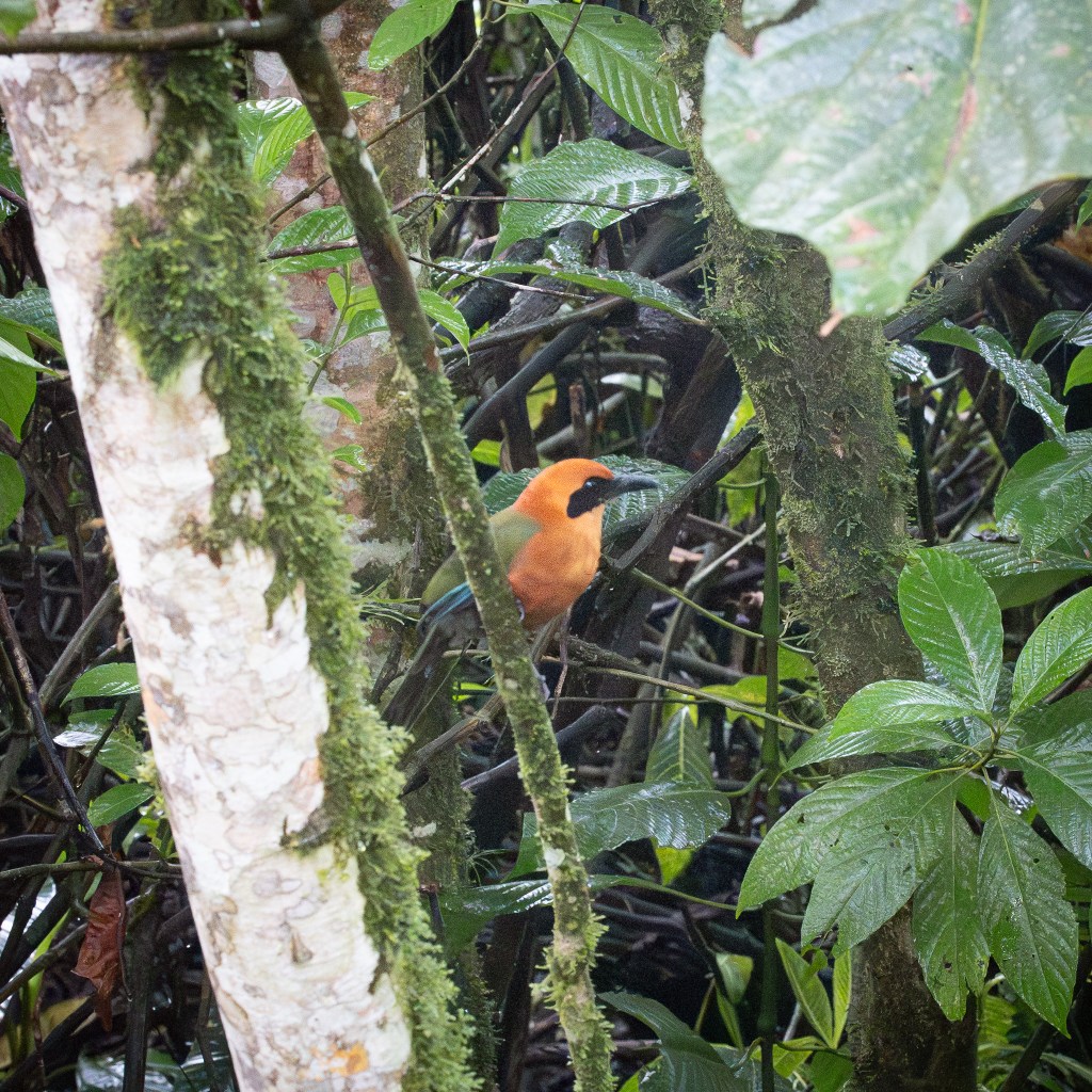
    The lush cloud forest hosts more than 500 species of birds, making Mindo one of the most exciting birding locations on the planet. Early mornings are particularly rewarding – standing outside in the mountain mist, moss covered trees, and a constant birdsong in the shadowy forest.

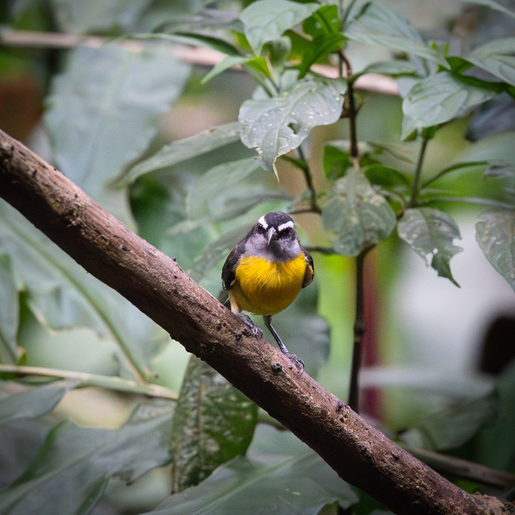
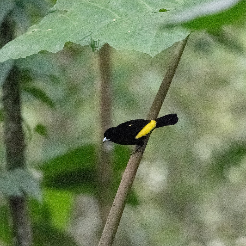
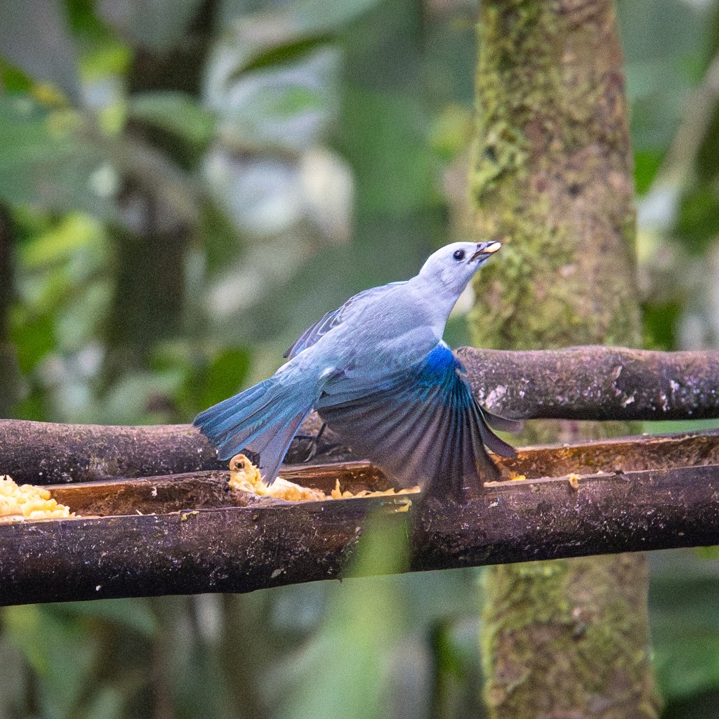
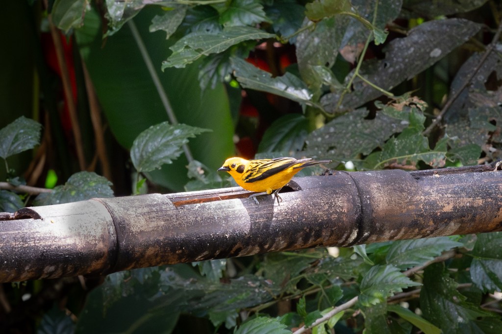
    Here are a few of my bird photos from the trip:

    Hiking to La Cascada Reina (The Queen Waterfall)

    Hiking to La Cascada Reina, Mindo Cloud Forest, Ecuador
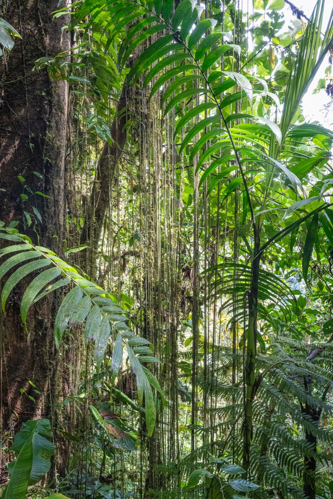
    Climbing deeper into the forest, each step takes me further into a world of green, where light falls softly and the world goes quiet.
    The stairs to La Casado Reina (The Queen Waterfalls)
    After an hour of hiking through the moist cloud forest, the trail ends here – where a strangely out of place concrete stairs leans precariously next to a waterfalls and disappears into the jungle of vegetation.
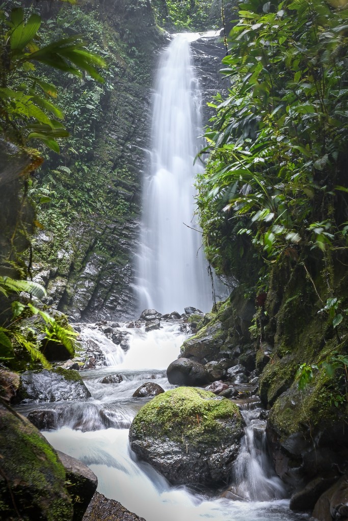
    La Cascada Reina in the Mindo Cloud Forest, Ecuador
    Climbing the stairs reveals La Cascada Reina – A crescendo of water pouring from the cloud forest canopy, carving over time, a hidden passage through stone and moss.
    The author descends the stairs at La Cascada Reina, Mindo Cloud Forest, Ecuador
    On the return, I descend the same steps that led me to La Reina waterfalls (barely visible over my left shoulder). It’s time for the hike back to the trailhead. And then for the uphill drive back to Quito.

    Site Icon
  • Cotopaxi: Following Humboldt and Frederic Church into the Andes

    Cotopaxi: Following Humboldt and Frederic Church into the Andes

    For as long as I can remember, I have been fascinated with the accomplishments and travels of Alexander Von Humboldt. Especially, his expedition across northern South America and Mexico between 1799 and 1804. I have the biography on Humboldt, The Invention of Nature, by Andrea Wulf. I also have volumes 1 and 2 of Humboldt’s notes and sketches titled, Cosmos: A Sketch of a Physical Description of the Universe. Much of this work comes from time spent on the Ecuadorian volcanoes of Chimborazo and Cotopaxi.

    Humboldt’s influence reached far and wide. His writings inspired other generations of naturalists and explorers, including Charles Darwin and John Muir. Humboldt also inspired the famous American landscape painter, Frederic Edwin Church of the Hudson River School.

    Frederic Church traveled to Ecuador in the 1850’s carrying Humboltd’s books and walking in the footsteps of the scientist and explorer he admired so much. Church’s awe-inspiring paintings of Cotopaxi and Chimborazo were more than landscape paintings, they were tributes to Humboldt’s vision of nature as both scientific and spiritual. Church was translating Humboldt’s written descriptions into iconic landscape paintings.

    I have the book, written by Louis Legrand Noble, friend and travel companion of Frederic Church to South America, who assembled his journals and letters into the book titled, Frederic Church’s Travels in South America. I also have a framed print of Church’s painting of the Ecuadorian Volcano, Cayambe.

    So you can imagine how excited I was to travel in the same footsteps of both Alexander Von Humboldt and Frederic Church!

    Cotopaxi

    Humboldt described it. Church painted it. And I took a trip to photograph it.

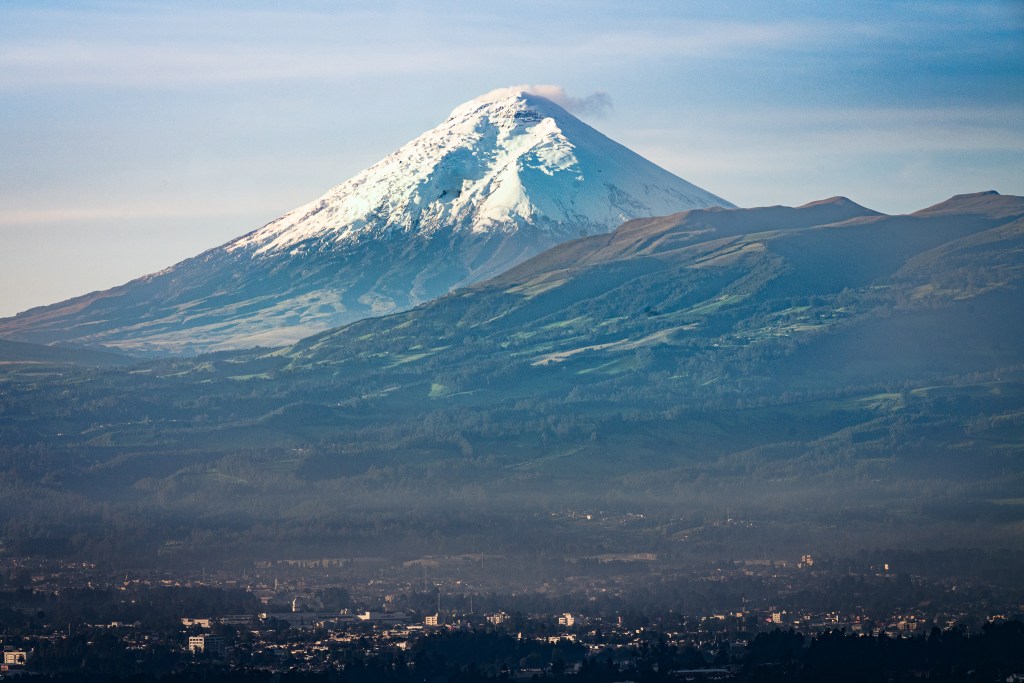
    The Stratovolcano Cotopaxi floats above the clouds and above the Cumbayá valley of Quito.

    Cotopaxi, appears above the clouds like an island of ice in the Andean sky. For the first week of my trip, I was staying in a home overlooking the Cumbayá Valley outside Quito. The elevation was high enough to catch intimate glimpses of the volcano when the ocean of clouds would temporarily part.

    Cotopaxi rises cleanly above the patchwork fields and towns of the Cumbayá Valley, Quito.

    On a rare morning, Cotopaxi rises cleanly above the patchwork fields and the Cumbayá Valley of Quito.
    The nearly perfect cone and crystal clear air (when the clouds aren’t present) explain why Cotopaxi is one of the most famous volcanoes in the world.

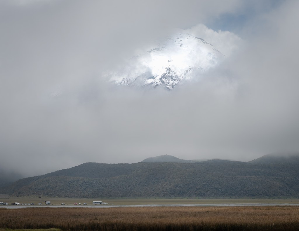
    Near the base in Cotopaxi National Park, the summit glows faintly through a veil of mist while the páramo grasslands stretch across the high volcanic plain.

    Locals say the young (geologically-speaking) Cotopaxi volcano is shy. She cloaks herself in clouds to hide her full splendor from those who come to peer at her.

    Near the base in Cotopaxi National Park, the summit glows faintly through a veil of mist while the páramo grasslands stretch across the high volcanic plain.

    The elevation here at Laguna Limpiopungo is 12,470ft! Cotopaxi peaks at 19,347ft. The vehicles, bottom-left, provide perspective.

    Standing above the tree line and just below the glaciers of Cotopaxi - Approximately 15.500ft elevation.

    Vegetation disappears somewhere around 14,000ft. Cotopaxi’s glaciers start around 16,000ft. I took this photo at approximately 15,500ft – nearly 3 miles above sea level. At this elevation, a deep inhalation provides only 60% of the oxygen I would receive at home in Wisconsin. And I was feeling it.

    Standing beneath Cotopaxi, I suddenly felt as if I’d been here before. I first experienced this volcano in the pages of Wulf’s biography of Humboldt, then again through his notes and sketches in Cosmos. Later this place came into luminous focus as I fascinated over Frederic Edwin Church’s paintings of these majestic mountains. The print on my wall of Church’s Cayambe reminded me the Andes really did exist somewhere out there.

    And now standing here with my camera, looking out over the expanse of the páramos, I imagine Humboldt with his barometer and Church with his sketchbook. Cotopaxi rises above me exactly as they must have seen it. Beautiful, mysterious, and timeless.


    Site Icon
  • Robert Roy MacGregor

    Robert Roy MacGregor

    The Scottish Highlands

    In 2012, I embarked on a road trip across the Scottish Highlands. I arrived in Edinburgh and departed from Inverness two weeks later. I had a rental car but no reservations anywhere, nor an itinerary. The main goals were to experience the lands of my ancestors and sample as many great Scottish whiskies as possible.

    I could write 6 months worth of posts from this trip alone. But today, let’s focus on one story in particular – discovering the gravesite of Rob Roy MacGregor.

    On the Road

    I spent the night along the shores of Lake Lomond. By morning I turned the car north, crossing the central highlands towards Glencoe – ground zero for the Clan Donald massacre. The sky was heavy and colorless. A soft mist pressed the narrow road to a ribbon of saturated green.

    Then a small sign flashed by.

    Faded white wood with a point cut into one end. Hand painted black letters, read:

    Rob Roy’s Grave.

    It took only a second to register the words. And in that second, I had already passed the turnoff.

    Rob Roy’s Grave!

    Foot on the brake.

    Balquhidder Glen

    Balquhidder is a quiet glen at the eastern edge of the Highlands. Home to a few scattered hillside farms overlooking lush green pastures and forest. At the bottom of the glen sits the long and narrow Loch Voil.

    The old Kirk and churchyard are nestled softly in the landscape a few miles from the main road. There’s no visitor center, no velvet rope, no docents or interpretive panels.

    Balquhidder Kirk

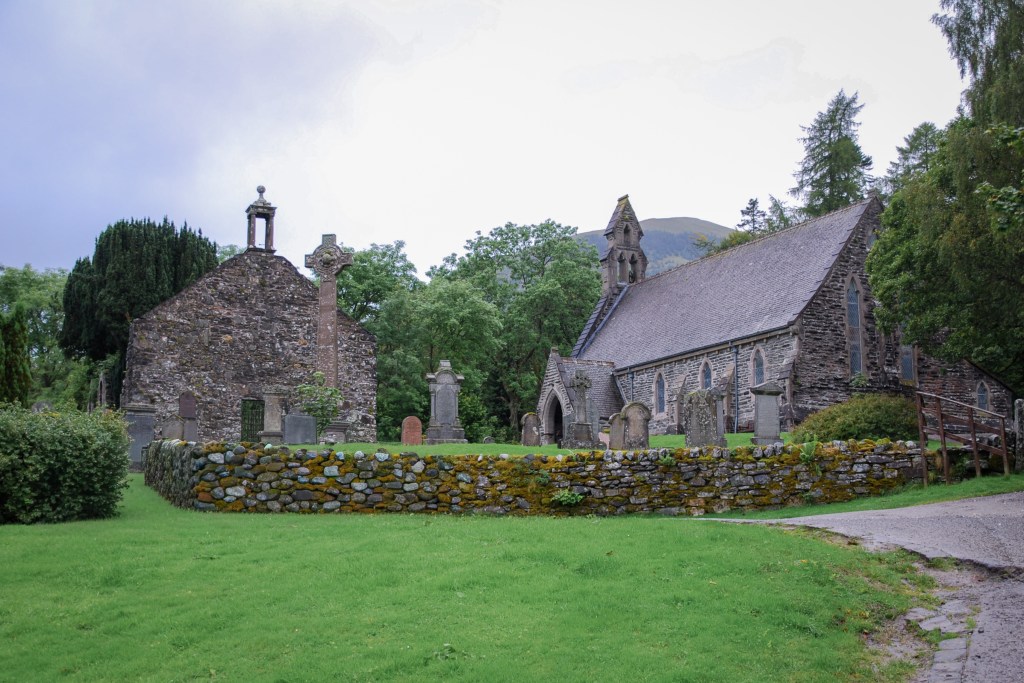
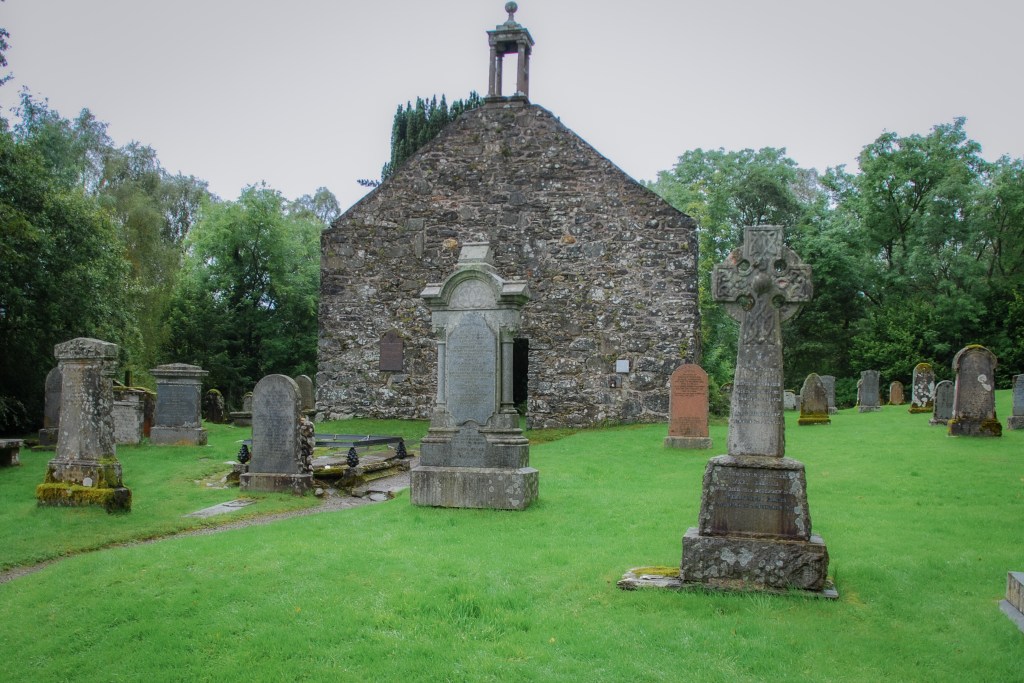
    The Balquhidder Kirk and graveyard.
    A remote Highland graveyard. Moss covered stones, Celtic crosses, and the old kirk stand watch over generations of an outlawed clan.
    Balquhidder Kirk and graveyard. Resting place of Robert MacGregor
    The resting place of Rob Roy MacGregor.
    Balquhidder Kirk and graveyard. Resting place of Robert MacGregor
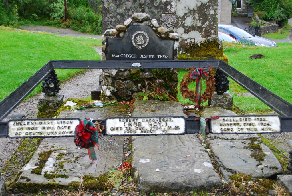
    The grave of Rob Roy is understated. It’s the smaller one to the left. The grave is distinctive only by the short, iron railings.

    In 1603, The MacGregor name was outlawed in the Highlands after defeating a rival clan aligned closely with the Crown. The proclamation stated that the name MacGregor was abolished. Anyone bearing the name must renounce it or be killed. They were forbidden to assemble, keep arms, or claim kinship. Anyone harboring them faced the same punishment.
    For nearly 150 years the MacGregors carried on by taking the last names of friends, neighbors, and relatives. But this was only words on paper. The families in the glen knew who was who. Generations were raised on a whispered lineage. A fractured and dispersed clan from afar. Hardened and determined from within.

    The Grave

    At the gravesite, you will notice three flat stones and three markers. This is not a monument to Rob Roy – it was never meant to be. This is a family plot. Here, Robert MacGregor is remembered as a husband and a father.

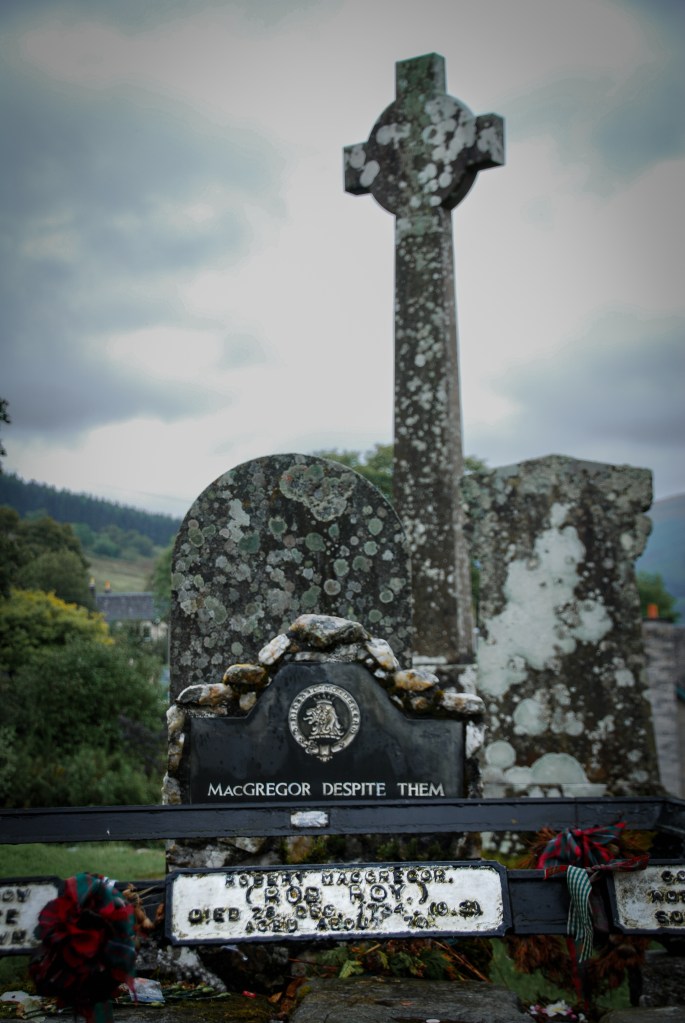
    The gravesite and headstone for Robert MacGregor, also known as, Rob Roy
    A few clan tartan wreaths are left by those who still feel the pull of resistance, and remembrance.

    The stone on the left is for his wife, Helen (Mary Helen) MacGregor. Her date of death is unknown. The center stone is for Robert. He died December 28, 1734 at about the age of 63. The stone on the right is a shared remembrance of their two sons. Coll died 1738 and Robert Jr. died 1754.

    The gravesite and headstone for Robert MacGregor, also known as, Rob Roy

    Why this matters

    This was never meant to be a shrine to Rob Roy the legendary rebel. Those stories and myth-making came much later. This gravesite makes a more personal statement. Although Helen lived much longer than Robert, she chose to be laid to rest beside her outlawed husband. She did this instead of being buried in her own family’s plot. The marker for the two sons doesn’t just give their names and dates. It proudly announces, “Sons of Rob Roy.”
    MacGregors Endure

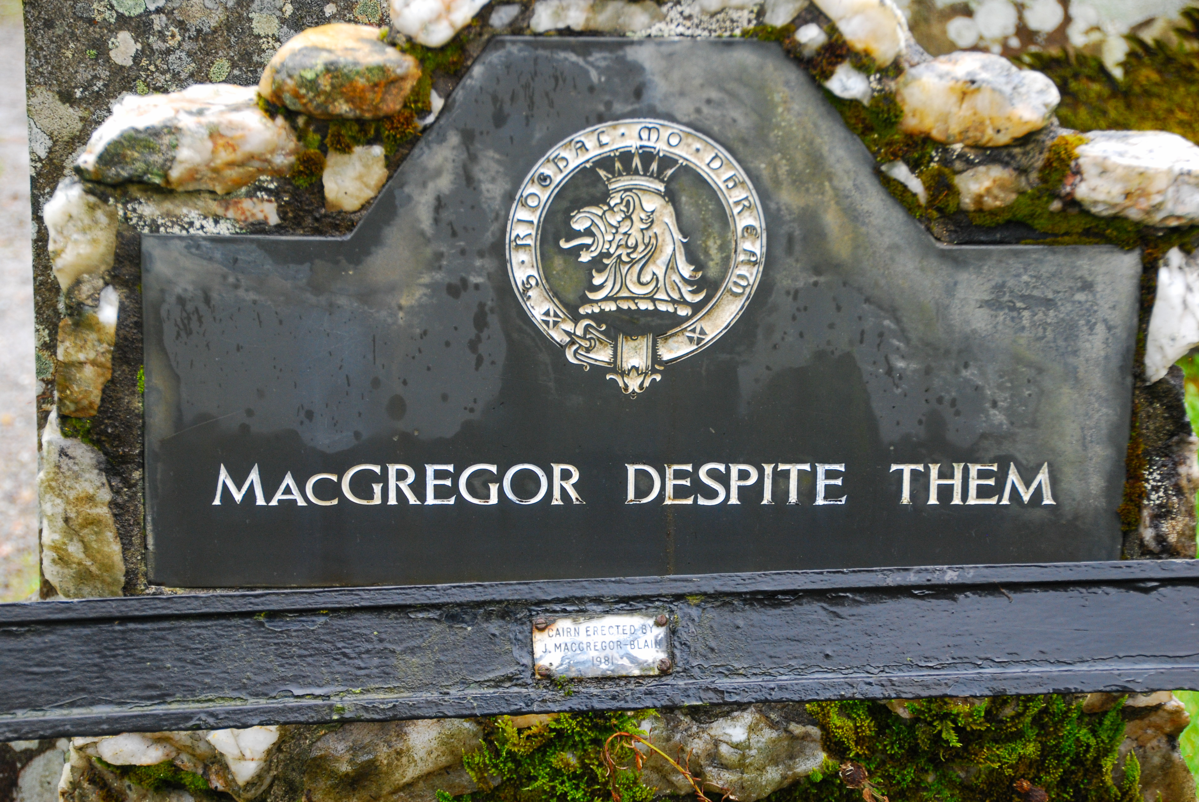
    In 1774, after 171 years, the MacGregor name was officially restored. Later, a headstone was erected on the gravesite reading “MacGregor Despite Them.”

    There are no records of who commissioned the headstone. No ownership is needed. The answer is implicit: those who endured long enough to reclaim their name – The MacGregors.

    The government tried to impose its will with a pompous decree. To eliminate a family’s identity by putting ink on paper. Instead, it created one of Scotland’s most enduring symbols of resistance.

    The gravesite and headstone for Robert MacGregor, also known as, Rob Roy
    “MacGregor Despite Them” An act of defiance carved into stone, and history, and the future.

    MacGregors Gathering

    Poem by Sir Walter Scott

    The moon's on the lake, and the mist's on the brae,
    And the Clan has a name that is nameless by day;
    Then gather, gather, gather, Grigalach!
    Gather, gather, gather, &c.

    Our signal for fight, that from monarchs we drew,
    Must be heard but by night in our vengeful haloo!
    Then haloo, Grigalach! haloo, Grigalach!
    Haloo, haloo, haloo, Grigalach, &c.

    Glen Orchy's proud mountains, Coalchuirn and her towers,
    Glenstrae and Glenlyon no longer are ours;
    We're landless, landless, landless, Grigalach!
    Landless, landless, landless, &c.

    But doom'd and devoted by vassal and lord.
    MacGregor has still both his heart and his sword!
    Then courage, courage, courage, Grigalach!
    Courage, courage, courage, &c.

    If they rob us of name, and pursue us with beagles,
    Give their roofs to the flame, and their flesh to the eagles!
    Then vengeance, vengeance, vengeance, Grigalach!
    Vengeance, vengeance, vengeance, &c.

    While there's leaves in the forest, and foam on the river,
    MacGregor, despite them, shall flourish for ever!
    Come then, Grigalach, come then, Grigalach,
    Come then, come then, come then, &c.

    Through the depths of Loch Katrine the steed shall career,
    O'er the peak of Ben-Lomond the galley shall steer,
    And the rocks of Craig-Royston like icicles melt,
    Ere our wrongs be forgot, or our vengeance unfelt!
    Then gather, gather, gather, Grigalach!
    Gather, gather, gather, &c.

    Check out this related post from the Outer Hebrides of Scotland

  • Opposite Seasons on Lake Michigan

    Opposite Seasons on Lake Michigan

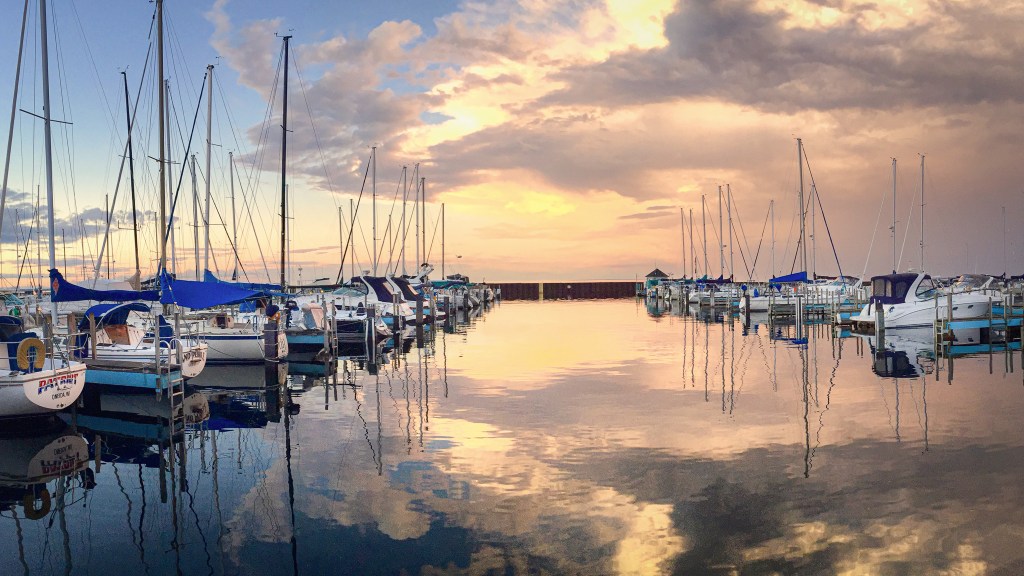
    These two photos were taken from the Menomonee Marina. Menomonee sits along the western shore of Lake Michigan, looking east across Green Bay.

    A frozen landscape of sky and Lake Michigan
    Looking east across Green Bay. Winter flattens the bay down to basic elements in gray—ice, sky, and a long frozen horizon that joins the two together.

    The above photo was taken on a gusty, sub-zero winter day from the breakwall seen in the image below.

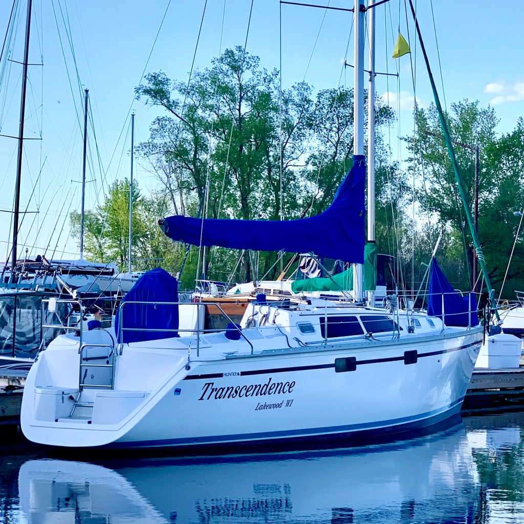
    The photo below was taken from the Menomonee Marina shoreline wall. Jennifer and I sailed here the night before from Oconto, Wisconsin – about a 5 hour sail.

    A beautiful summer sunrise at Menomonee Marina on Lake Michigan's Green Bay
    Menomonee Marina – the harbor fills with masts, color, and reflected light during a magical summer morning on the Great Lakes.

    The Sailing Vessel, Transcendence
    The Sailing Vessel, Transcendence – Our Cabin on the Lake
  • The Cats of Istanbul

    The Cats of Istanbul

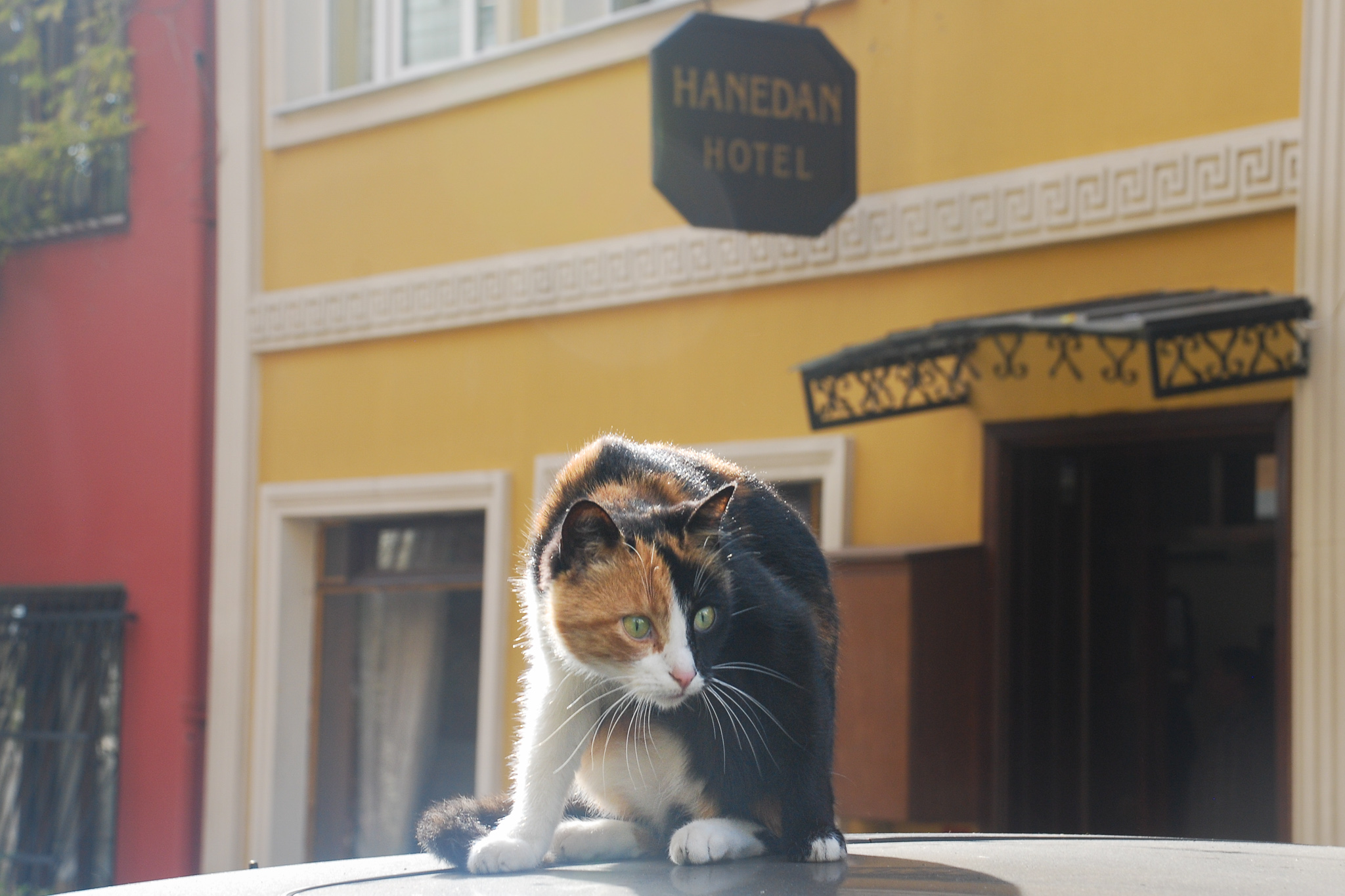
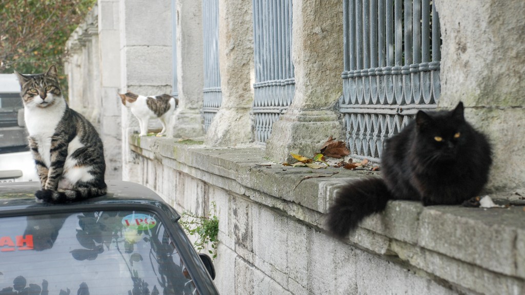
    In Istanbul, cats are everywhere, moving through the streets with the quiet confidence of locals – because they are. They perch themselves on the roofs of cars, lounge on sun-warmed stone ledges, relax in a cushioned chair next to you at an outdoor cafe.

    Here, the street cats aren’t strays in the Western sense of the word. They’re not mangy vagrants haunting the margins of urban existence. The cats are part of the neighborhood in Istanbul, giving the city character and rhythm.

    The Residents

    Three cats loitering on a street in Istanbul
    A cat relaxes in the morning sun along the streets of Istanbul
    A group of cats nibble on food that's been provided by the local residents

    In much of Muslim culture there’s a deep sense of compassion toward animals. In Istanbul that shows up as an everyday shared responsibility to care for the cats who live alongside them. It’s common to see little food bowls tucked in doorways and water left out on hot days. You can find little improvised shelters, like troll houses in gardens, for the cats in winter.

    In a city as old as civilization itself, thousands of people acting with sympathy turn acts of kindness into a feline infrastructure.

    Coffee (and nap) Time

    After choosing an outdoor table to enjoy a cup of Turkish coffee, I glance over and discover it’s already claimed by two kittens. They don’t mind sharing. Soon, we’re joined by their mother. Despite the strong coffee, I find myself thinking about a nap afterwards.

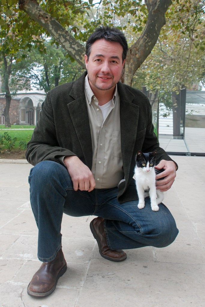
    The author with a kitten in Istanbul, Turkey
    The author in Istanbul, Turkey, enjoying the afternoon with a local tour guide.

    Site Icon

    Check out this post about a day trip along the length of the Bosphorus from Istanbul to the Black Sea:

— Anthony Bourdain