The author taking in the vista on Antelope Island, Great Salt Lake

Tag: badlands

  • The Badlands

    The Badlands

    Geology of the Badlands of South Dakota

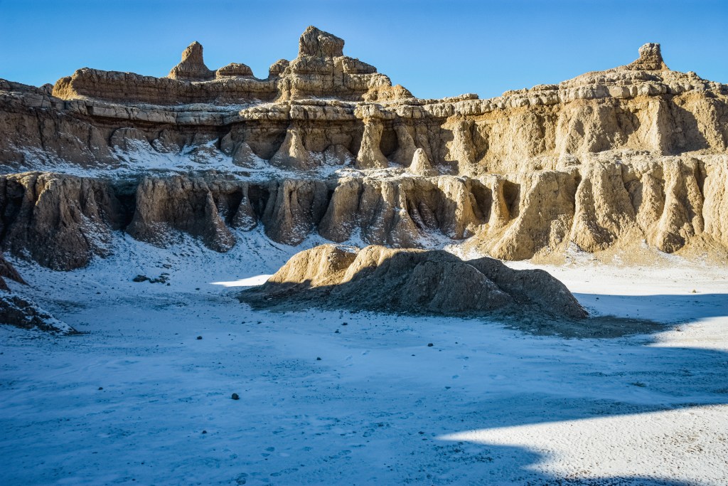
    The geology of the Badlands isn’t a story of dramatic uplift like its neighbor to the west – the Black Hills. Instead, the Badlands is a story of what millions of years of erosion stripped away.

    Over a period of 75 million years, ancient rivers, inland seas, and volcanic eruptions laid down ribbons of sediment. The sediment was compressed into very soft and fragile rock formations such as: mudstone, siltstone, shale, and ash.

    The Black Hills uplift shifted water flow to the east into soft sedimentary layers. The erosion carved buttes, towers, ridges, and canyons into what is now known as the Badlands.

    The Badlands of South Dakota with a dusting of early winter snow
    The Badlands of South Dakota – early winter
    Spires of the Badlands lift up out of the grassland prairie
    A ribbon of prairie cuts toward the distant spires, revealing the intriguing boundary between grasslands and Badlands
    Color-washed mounds of ancient volcanic ash rise from the grasslands.
    Color-washed mounds of ancient volcanic ash rise from the grasslands. The yellows and purples indicate different minerals in the sedimentary layers.

    The Process Continues

    When we visit the Badlands today, we see a unique landscape still in the making. Erosion is Nature’s sculptor. Working through rain, wind, and the freeze-thaw cycle, it continues to pare back the cliffs at a rate that is one of the fastest in North America.

    Architecture of the Badlands exposed beneath a dusting of snow
    A quiet winter basin carved by centuries of erosion. The skeletal architecture of the Badlands is on display beneath a dusting of snow.
    Recent rains run in rivulets through the soft sediments. Sculpting of the Badlands continues.
    The sculpting of the Badlands is still evident today. Recent rains run in rivulets through the soft sediments.
— Matsuo Bashō